Quantcast
Channel: Geotripper
Viewing all 1206 articles
Browse latest View live

Who Needs Science Anyway?

$
0
0
Interesting creatures used to live here in our valley...
Why go through the trouble of teaching science? Who's interested in it anyway? Everyone knows that the real money (and that's all that counts) is in finance, economics, real estate, medicine (oops, that's science), and pop culture. And sports. And research just isn't a priority for our country. The Chinese do it better anyway. There just isn't the interest in science among our children. They just don't care these days. Why teach science when no one wants it?
Checking out radioactive ores with a Geiger counter.
The kids in our community provided us a resounding answer today. Hundreds of people came out today to our new Science Community Center for our Wild Planet Day Celebration, a fundraiser for our newly expanding Great Valley Museum. Hundreds of kids, learning about all manner of chemistry, physics, biology, geology and astronomy. Our planetarium shows were filled to overflowing, kids swarmed over our fossil and mineral specimens, they held a 15 foot long python, they made bug models and dissected squids. Hundreds of people.
Identifying minerals using acid, glass and luster
Our educational system seems at times to be leaving science behind. Funding of science education gets cut in favor of standardized testing of the "basics", as if anything is more important than science in our society. And yet there can be no doubt that our kids hunger for science, and so do their parents and grandparents. Our very own community, poor as it is (we've never pulled out of depression-level unemployment levels), passed a bond issue that paid for the construction of our Science Community Center, one of the finest science teaching facilities in the state.
Picking out a few free samples.
I'm proud of my community. The students here never cease to amaze me when we have events like this. They are so enthusiastic, so hungry to learn about the science that they never seem to see in their schools, their media, or their computer games. And for some of them, the science sticks. I've been teaching long enough that some of my students at the college will tell me their interest began at events like these a decade previous, or at Science Olympiad competitions when they were in junior high.
What are they doing? Checking out fluorescent minerals.
We can't let these kids down. Our society depends on a scientifically literate electorate. We need to have legislators who recognize the need for scientific research that is untainted and unbiased by corporate funding. Basic research pays huge dividends for the society that pays for it, and we aren't doing so well in that category anymore.
Photo by Mrs. Geotripper
 I was inspired today. These kids give me a lot of hope about the future...
Photo by Mrs. Geotripper


Scenes from a Shield: Traversing California's Biggest Volcano

$
0
0
Continuing on with our late September exploration of the California Cascades, we prepared to leave Lava Beds National Monument. The main paved access is from the north at Tulelake, but our interests lay to the south over the top of the biggest volcano in California: Medicine Lake Highland. MLH is a shield shaped edifice, but the history and composition of volcano suggests a complicated history that is quite distinct from shields like those in Hawaii and elsewhere. Lava Beds National Monument covers about 10% of the shield complex on the north flank. We headed up the good gravel road to the highest corner of the park where we could investigate the source of the lava flows and tubes at Mammoth Crater.

Before reaching Mammoth Crater, we stopped at Heppe Caves to catch an unusual sight: water! Very few sources of open water exist at the Lava Beds. Fracturing of the basalt allows water to seep into the ground quickly and no streams or canyons can be seen in the park. At Heppe Cave, a deep layer of ice allows a small pool of water to persist in the lowest part of the huge cavern in most years. Birds and other animals depend on the pool, despite its diminutive size.
We had gained several hundred feet from the vicinity of the park campground and visitor center, and the cooler wetter climate allowed for the growth of ponderosa pines, and to my surprise, a small aspen grove! These stunted trees are not a common sight in the area.
A few hundred yards up the road brought us to Mammoth Crater, the source of the lava flows that cover about 70% of Lava Beds National Monument (and which produced many of the lava tubes). During the eruptions, the crater would have been a lake of molten lava, spilling over in several directions. In the waning phases of the eruption, the lava drained away, leaving a pit a quarter of a mile across and several hundred feet deep.
People often think that volcanoes erupt only from their summit, but we were quite a few miles short of the summit of Medicine Lake Highland. The mountain is covered with cinder cones and lava flows that originated from vents on the flanks of the volcano.
 It took a few false starts, but I finally located the obscure track that left the main "highway" and took us to these unusual holes in the lava. Does anyone want to speculate what they might be??
The two holes above joined about two feet down. People can reach in and hold hands underground. A few of the mysterious holes are quite large and deep. The deepest sometimes have snow all summer.
Another one or two miles through the thick forest brought us to the edge of the Medicine Lake Highland caldera. It is about as wide as the Crater Lake, some four or five miles, but beyond the horizontal distance, there are few similarities. Crater Lake has cliffs that drop straight into the lake, where MLH has rounded glaciated knobs and peaks. Crater Lake has a nearly 2,000 foot deep lake, where MLH as a lake that barely makes it past 100 feet in depth. Mt. Mazama, the mountain that existed prior to Crater Lake erupted just 7,000 years ago. The eruptions that produced the caldera on MLH took places tens of thousands of years earlier.
Medicine Lake technically shouldn't exist on a mountain that notoriously sucks up all the water. It seems that the glaciers that formed on the mountaintop produced and scraped up enough clay to seal the bottom of the lake and keep the water from draining away.

It was in the low to mid forties while we stood on the shoreline, and it was drizzling. But the sign said "swimming beach", so my students, who always follow what the signs say...
 ...did just that: went swimming in a subalpine lake. I make no judgements here, but I had a bone-chilling cold day, and it didn't help to see them swimming away!

Our next stop: the last thing you would expect to see on a basaltic shield!

Arrogant Politicians, Government Shutdowns, and our Underappreciated Public Servants: The Rangers and Staff of the National Park Service

$
0
0

I am appalled at what has transpired over the last two weeks, and I can only describe the behavior of certain individuals in government as reprehensible. In a nutshell, a political party decided that a law that was duly enacted by Congress, signed by the duly elected President, affirmed by the Supreme Court, and affirmed again by a presidential election, needed to be stopped by any means possible. They threw out the Constitution that they so dearly claim to love that describes the process for making laws, and instead held millions of government employees, veterans, children, and others hostage, claiming that they would even cause our nation to default on its bills if they didn't get their way.

For all of the horrific things that happened, the most symbolic was the exchange that took place between Representative Randy Neugebauer (R-Texas) and a ranger at a war memorial. He voted to shut the government down, and then had the audacity to berate her for doing the job she was ordered by him to do. As if it was all her fault. No one deserves a supervisor like that (see the sordid episode here: http://www.youtube.com/watch?v=v5Du5FHBQ-w#t=16 . I'm glad people in the crowd stuck up for her).

I admire the people who have chosen to serve their country in the National Park Service. They are paid poorly and don't always have job security (when federal budget cuts come, the NPS gets cut first, even though they make up an infinitesimal part of the budget). And they are trained to take a whole bunch of crap from morons who think that the laws of society and civility don't apply in the parklands they are visiting. And they are marvelous role models for legions of children who are introduced to the outdoors in part due to their leadership. I know I was impressed with rangers when I was a child. It was one of the things I wanted to be when I grew up (I'm still wanting to be a ranger, just as soon as I grow up...).

I feel so bad for people who had planned for and traveled to national parks, but were prevented from doing so by the privileged members of Congress who barely seem aware of the damage they have done. I especially feel for the folks who couldn't start their river trips on the Colorado River, something that requires years of waiting for permits, and months of planning, and thousands of dollars. I wasn't able to introduce my students to Sequoia and Kings Canyon National Parks last weekend. We had to go somewhere else.

I've been telling myself that the importance of closing down the parks was not as high a priority as caring for veterans or feeding kids in Head Start, but I'm not so sure now. Our National Parks and Monuments are the symbols of what is best about America, and we should be caring for them and promoting them to the world as our best ever idea. I don't care how big our missiles and planes and ships are. It says so much more about what we value as a people that we have set aside our most beautiful and precious places for future generations. Our parks should not be neglected; they should be cared for and improved, and staffed by sufficient numbers of rangers that they can protect the resources, and provide expert interpretation for all park visitors.

Take a look at this link at Anonymous Rangers (http://npexperience.com/blog/2013/10/15/anonymous-rangers ) and have a look at the beautiful video they provided. And let a ranger know you appreciate their hard work and sacrifice. They are the best of America! (including you, Gaelyn!)

Scenes from a Shield: Isn't This Supposed to be Basalt?

$
0
0
Medicine Lake Highland (from an earlier trip when it wasn't covered with storm clouds).
Medicine Lake Highland at first glance sure looks like a classic version of a shield volcano. The gently sloping flanks indicate the presence of non-viscous basaltic lava, and the lava tubes we explored were certainly composed of basalt. As we moved further up the flanks of the mountain we encountered tree molds (those were the mystery holes in the previous post, as Lockwood correctly surmised) that also occur in basalt flows. By the time we reached the summit of the volcano and the caldera at Medicine Lake we were starting to see different kinds of lava. Some gray colored andesite could be seen on the north flank of the caldera.

The most striking kind of lava was what we saw at Glass Mountain, the most recent lava flow on the mountain, dating to only 900 years ago.

Everything about Glass Mountain is a complete contrast to basalt. The steep debris-covered flanks of Glass Mountain show that the lava flow was highly viscous and barely able to flow at all. The light color of the lava contrasts sharply with the black of basalt. The mountain is composed mostly of obsidian and pumice, glassy rocks that usually have a chemical composition equivalent to rhyolite.  
Glass Mountain is a typical example of a plug dome. Such volcanoes are small, usually no more than a thousand feet tall, with steep rubble-covered sides. The lava flows from the cone are rarely very long, and are thick and very rugged.

One might wonder what rhyolite is doing on the summit of a gigantic basaltic shield volcano. Such things are not usually seen on Hawaiian shields, for instance. A bit of information about the melting points of minerals and the composition of the crust can help us to understand what happened on Medicine Lake Highland.

The minerals found in basalt have high melting points. For basalt to be in a liquid state requires temperatures of 2,000 °F or more. Rhyolite on the other hand contains minerals that melt at lower temperatures, maybe in the range of 1,300 °F.

Oceanic crust is essentially composed of basaltic rock. Continental crust is more granitic in composition, and granite is what you get if rhyolite cools very slowly (granite and rhyolite are made of the same minerals, in other words).

Medicine Lake Highland is situated on the diffuse boundary between the Cascades Province and the Basin and Range, a region that is being stretched or extended in an east-west direction. The extension is causing faults to form in the crust, and the faults are allowing basalt to approach the surface from its source in the Earth's mantle. The basalt magma, as noted, is very hot.

As the basalt rises through the thick granitic crust, the intense heat causes melting of the granite, and magma chambers form that are composed of rhyolite. The basalt and rhyolite magmas don't play well together, and don't readily mix. As a result, some eruptions are basaltic, and others rhyolitic. This phenomenon is called bimodal volcanism.

Many people don't realize that pumice and obsidian are the same thing: volcanic glass. They are the same in the way that root beer and the foam on the root beer are the same. It's all root beer, but the foam is full of air bubbles. A bit of exploration on the flow at Glass Mountain revealed intriguing flow structures with interlayered pumice and obsidian.

We finished our exploration of Glass Mountain and headed down the heavily wooded south flank of Medicine Lake Highland. Brief views through the trees offered wonderful vistas of the surrounding terrain of the Modoc Plateau.

Medicine Lake is not a "typical" Cascades volcano like Rainier or Shasta but there is at least one other massive shield complex to the north in Oregon at Newberry Crater. Both are famous for their obsidian domes.

We had one more stop for the day, on the Giant Crater Flow, a basalt flow that is comparable to the Mammoth Crater flow that produced the lava tubes in Lava Beds National Monument. One tube system from Giant Crater extends for fourteen miles down the south flank of the Highland. At Jot Dean Cave, there was an extraordinary exposure of ice.

Jot Dean Cave doesn't seem to extend all that far, or at least none of us wanted to find out. The reason is the rather steep slope at the edge of darkness that is completely covered with very slick ice, even in late September. The strangest part is the huge mass of ice on the left side of the entrance that refracts light from the outside and seem to glow internally. It's actually kind of eerie; I imagined that the ice had formed around some poor spelunker and his light was still glowing...

We got back into the vehicles and headed towards our camp for the evening at one of California's most beautiful state parks.

It's Just a Damned Rock...or Stalactite...or Wolf...or National Park. Where does it stop?

$
0
0

The subject of today's post grew out of several news items from the past few weeks, and a walk underground that I took yesterday.

I'm going to start with a bit of a mental exercise. Imagine a cavern in a place like the Sierra Nevada foothills, a cave that was discovered by miners in the 1850s, and offered up as tourist stop for the next 30 years or so. Think how attitudes about caves differed in those days. Visitors regularly broke off stalactites as souvenirs, and many carved or wrote their names on the walls. Imagine a cave where such activities continued until few speleothems (cave decorations like stalactites and stalagmites) were left, and people lost interest in visiting the site. It fell into disuse and was abandoned, forgotten by all but a few spelunkers, and even they rarely visited.

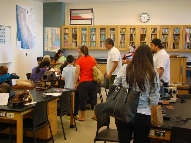
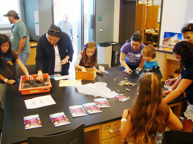
Skip forward a century or so. Spelunkers explore the cave, and find some indications of deeper passageways, maybe a pile of rubble, or perhaps a cool breeze coming from a small crack in the wall. They start removing the rubble, and realize that a narrow passage may reach into deeper recesses never discovered by the miners and early tourists. Weeks of work and they break through into a new room, a room never before seen by human eyes. A room full of stalactites and other features never broken off or smudged by soot. As a geologist and explorer of the Earth, I've dreamed of doing something like this, but I can't quite fit in the tight passages the way I used to in my youth (not to mention a sense of claustrophobia!). Luckily we can experience something like this discovery in several of California's beautiful caverns, especially Black Chasm, and the subject of today's photography, California Cavern. We visited yesterday as part of a field studies class in the Sierra Nevada foothills.

California Cavern is owned and operated privately, and some parts of the cavern system are utilized extensively for recreation, but they've done a good job of protecting the gem of a room that was discovered in the late 1980's. It's called the Jungle Room and it is full of some of the most delicate speleothems I've ever seen. The most extraordinary are the soda straws, thin long stalactites that look so delicate that a single touch could break them off. And they haven't been broken.
The tour guides spend their time in the first barren looking rooms talking about how the miners and early tourists used to use this room for court, that room for meetings and this other room for preaching or marriage ceremonies. They point out the carvings and other graffiti on the walls, but mostly what I see is destruction of anything within the reach of hands or long sticks. It is sad to think of what was lost in the inkling of time, those few years out of hundreds of thousands that humans entered into these underground openings.
I don't think that the early visitors acted out of maliciousness, just ignorance, but I am seeing a new class of people these days, destructive people who wish only to destroy, for reasons I cannot begin to fathom. I think of the arsonists who would destroy ancient forests, and people who would take advantage of a government shutdown to invade and destroy the beautiful parts of our national parks and monuments.

I wonder if that idiot Representative Randy Neugebauer, who berated a park ranger who was (unhappily) erecting barriers at one of our war memorials, gave even a moment's thought to what could have happened if the park service left the memorials unprotected and unpatrolled. All over the country, terrible people wandered into parks, leaving behind vandalized facilities and obscene messages.
Caves can sometimes be protected behind locked doors, but other caves are unprotected. Every year more damage is done. And sometimes those responsible will say things like "it's just a single damned stalactite, it's just a single rock, it's just a single wolf I shot", it's whatever someone felt justified in destroying. And since we find that corporations are "people too", we have corporations who say "it's just another damn forest, or river, or meadow" that we want to develop, or log, or mine. What will it hurt to destroy just one more?
I love seeing perfection. It happens so rarely, and it is always so fragile. That's what I was able to observe yesterday, deep inside the mountainside. Our Earth is fragile too, and we've already done so much damage.
On the way out of the cave after our tour I noticed something that I hadn't seen before. Some of the stalactites were repairing themselves! It was only the littlest change, but some of the soda straws and stalactites were growing again, and I realized that in at least some caves, the features may return, probably long after we humans have become extinct and perhaps replaced by beings with a better sense of beauty. It left me with a little bit of hope.

So I end with the morons in Utah's beautiful Goblin Valley, one of my favorite places to visit. Yeah, it's just another damned rock. Who really cares if we push it over? There are hundreds of others. What will it hurt? And besides, they were "saving lives". They are morons, maybe, and deserving of punishment. Because I love places like Goblin Valley, my first impulse is that they ought to go to prison, but on second thought, it might be better if they get a sentence of community service, hopefully teaching others the importance of protecting the wild places instead of destroying them. It's not likely that the message will sink in, but one can hope.
 

Rivers Appearing Out of Nowhere: McArthur-Burney Falls State Park

$
0
0
Note: Sorry for the odd character of the photos. My hike was at dusk, and lighting was difficult!

There's no doubt that McArthur-Burney Falls are absolutely spectacular, almost otherworldly. Burney Creek spills over a high ledge of basalt and is joined by myriads of whitewater springs bursting out of the cliff below. It falls into a gigantic deep blue pool of water before flowing down to the reservoir a mile or so downstream.
It is cool and moist even in the driest and hottest part of the year, because the springs that feed the fall are practically impervious to seasonal changes. A lot of water passes through the park each day, something like 100 million gallons every 24 hours.

The geology is interesting. The region includes horizontal flows of basaltic rock along with intervening layers of lake sediments and diatomite. The basalt is jointed and broken up and allows water to sink quickly into the ground (surface streams are surprisingly rare in this wet climate). The diatomite and siltstone layers are impermeable and don't allow water to sink deeper into the ground. It is instead forced to flow sideways until it flows out at a spring such as those in the face of McArthur-Burney Falls
What makes the falls more intriguing is the incredible contrast between the river downstream and upstream of the falls. Downstream, Burney Creek has a sizable flow, as seen below.

I decided to check out the river upstream of the falls and headed up the trail. Fall colors were just beginning to make an appearance.
I can now say I spent some time this summer on the Pacific Crest Trail. A whole mile of it, in fact! It runs through McArthur-Burney Falls State Park on the west side of the creek. It was quiet and quite devoid of other hikers on the Sunday evening when I was exploring.
At the upstream end of the park, Burney Creek is AWOL. There is only a dry channel lined with basalt boulders, aspens and willows.

Making my way downstream, I found a spot where the river appears as a series of pools, but at this point it is not yet flowing. The water table is intersecting the channel of the stream and rising to the surface.
Just a bit further downstream, the river has grown, and after a few hundred yards more, it is a large stream that makes the bold leap over the ledge of basalt.
This has been a strange landscape we have been traveling through, an entire shield volcano with no surface water beyond a glacial lake at the summit caldera, and a lava plateau, also with limited water. Yet the climate is wet, and is ultimately the source for much of the water flowing in the Sacramento River.

I headed back to camp. Tomorrow was the last day of the field class, and we were going to pay a visit to Lassen Volcanic National Park!

Chaos! The Jumbles and Crags of Lassen Volcanic National Park

$
0
0
Lassen Volcanic National Park is one of the lesser-known and less visited of the national parks in California. Many have heard of Lassen Peak, but the park is located in the northern reaches of the state relatively far from most population centers. It's a fascinating place, and if one is interested in volcanism, there are examples of practically every type of volcanic feature within the borders of the park. How many places in the world have shields, lava plateaus, stratovolcanoes, plug domes, cinder cones, and calderas, as well as active geothermal fields (fumaroles, boiling mudpots, and hot springs; everything except geysers, so Yellowstone can rest easy). The park is also noted for the recency of many of these features, with numerous cones and flows that are less than a few thousand years old (Lassen itself erupted from 1914-1917).

On our recent trip, we approached the park from the north, and the first sight we beheld was beautiful Reflection Lake. In the morning light it was serene and quiet, and it was strange to consider the violence that led to the lake's formation (along with nearby Manzanita Lake). The forest hides the hummocky surface of the landscape that surrounds the lake, but a short distance up the road, the origin of the lake becomes clear.
The Chaos Jumbles is the remains of a large debris avalanche that thundered down the slopes of  nearby Chaos Crags. The lack of soil and vegetation suggests that the avalanche deposits are not old (there are at least three of them), and indeed none of the trees on the slide date to more than three hundred years. The slide traveled on a cushion of compressed air, traveling for more than two miles and climbing some four hundred feet up the slope on the far side of the valley. It blocked several streams, ultimately forming the beautiful lakes.
The rocks that make up the slide are quite interesting as well. They are volcanic, but not the black basaltic rock that people associate with lava flows and volcanoes. It is a pinkish brown volcanic rock called dacite. Dacite is intermediate in composition between rhyolite and andesite, containing the minerals quartz, plagioclase, hornblende and biotite. The volcanic rock also contains enclaves of a darker volcanic rock, an andesitic basalt that shows that two different magma chambers were comingling and mixing. The mixing probably was a factor in the eruptions of the dacite.
An aerial shot of the Lassen vicinity shows the Chaos Crags in sharp outline. They are the barren snow-free peaks to the left of the main cone of Lassen Peak (the Crags lie north of Lassen; the picture is oriented towards the southeast). Given the dense thick forest that surrounds the volcanoes and the barren nature of the Crags, they have to be exceedingly young, and dating indeed places their age at about 1,100 years before the present. Six individual domes were erupted during a period of about 60 years.

The Chaos Crags are excellent examples of plug domes, short steep cones produced by highly viscous lava flows. The lava emerged like toothpaste from the ground, and as it cooled, the surface of the lava contracted, breaking up and forming huge debris piles on the margins of the cone.

The six domes have been creatively named A, B, C, D, E, and F. Domes E and F can be seen in the picture below, while Dome D dominates the bottom picture.

In any other setting, the Chaos Crags would be the central focus of a volcanic park, but the much taller peak of Lassen stands less than two miles away, so they tend to be somewhat ignored. That's too bad because there are few better examples of plug domes to be found anywhere, and the youthfulness of the Jumbles suggests continuing geologic activity. A stop among the chaos of the Crags and Jumbles is a great introduction to the geology of Lassen Volcanic National Park!

The Volcano That Doesn't Exactly Look Like a Volcano: California's Lassen Peak

$
0
0
Lassen Peak is an odd one. Most people have a stereotypical view of what a volcano "should" look like, and to most people, Lassen doesn't fit the stereotype. Yes, it is an isolated peak from most angles, but where is the cone shape, and where is the crater on top?


We were on the last day of our late September field studies course through the Cascades of Northern California, and were having a look at the volcanic features of Lassen Volcanic National Park. In the previous post we took in a fascinating set of six plug domes, the Chaos Crags, and the debris avalanches that thundered down their flanks forming the Chaos Jumbles.

Like the Chaos Crags, Lassen Peak is a plug dome, a steep rubble-covered peak composed of dacite or rhyolite. It may be the largest plug dome in the world, rising about 2,000 feet above its base (most domes are half of that). It lacks the characteristic cone shape of stratovolcanoes because its lavas were so viscous upon emerging from the depths that they barely flowed at all, forming a steep pile of lava rather than relatively smooth slopes. As the lava cooled, it contracted and broke up, forming the talus slopes that coat most of the mountain.  A few rugged cliffs of solid dacite stick out here and there. The peak tops out at 10,457 feet, so it is often coated with snow.

Lassen Peak emerged during a series of eruptions about 28,000 years ago. The entire mountain probably developed in just a few years. Its shape was modified by latest episode of Pleistocene glaciations, but it was otherwise dormant for tens of thousands of years. Until 1914, that is...

In May of 1914 a steam explosion rocked the top of the mountain, producing a small crater on the summit. Over the next year at least 180 explosions blasted away at the summit, ultimately producing a 1,000 foot wide crater. The eruption made news across the country. Brave but foolhardy souls climbed to the summit to have a look, including several men who were standing at the summit on June 14th when B.F. Loomis made the famous images reproduced below (these are pictures I took of the displays in the Loomis Museum at Manzanita Lake).
One of the men, Lance Graham, was walloped by a rock in the shoulder and in the panicky moments that followed was left for dead near the top of the mountain. A rather lurid NY Times story described him as actually being dead, his arms cut off, a deep gash exposing his heart, and his body nearly torn in half; a later correction stated : "...he was reported to be dead, but the latest word is that he still is alive, although fatally injured". He apparently survived to live a long life (I recounted this story in one of my classes, and a surprised student piped up saying "Graham? He was my great grandfather!").

On May 19th of 1915, lava emerged from the volcano for the first time. The thick flow melted thick banks of snow and produced a major mudflow, or lahar, that traveled many miles down two valleys on the north flank of the mountain, destroying six ranch houses.

Source: National Park Service. Photograph by R.E. Stinson
The volcano was quiet for two days, and some may have thought the eruption was subsiding. It wasn't. On May 22nd, a huge explosion lifted ash 30,000 feet into the sky. A plume of hot ash swept down the north flank of the mountain, destroying the forest and all living things over an area of three square miles (these hot ash clouds are called pyroclastic flows or surges). This site is called the Devastated Area, and the demarcation between the old forest and the pyroclastic flow is still clear. The mountain has been quiet since 1917 (except for a puff or two of activity in 1921)

The eruption of Lassen Peak was for sixty years the only volcanic activity to take place in the lower 48 states, and as such was often the main topic of discussion in the volcanoes chapter of geology text books. It was a "nice" eruption in that it displayed many diverse phenomena (steam explosions, ash flows, lava flows, and mudflows), and didn't kill anybody (despite Lance Graham's near miss with mortality). Even though Mt. St. Helens stole all the attention, Lassen Volcanic National Park remains one of the best places I know of to learn about volcanism. And it is a beautiful place to visit.

More in the next post!

An excellent description of the 1914-17 eruption can be seen here: http://www.nps.gov/lavo/naturescience/upload/eruptions_of_lassen_peak.pdf

Duck Creates "Water Color" Art: Autumn in Yosemite Valley

$
0
0
You are welcome to call this my strangest blog post ever (and I've had plenty), but I was just captivated today. I live just two hours away from Yosemite Valley, and I visit every chance I get, and a bit of simple math tells me I've been in Yosemite around 80 times in the last quarter century. I never get tired of visiting, but I do have a standing rule of trying to discover something new and different every time I go. Sometimes it's a new mood, brought about by sky and weather conditions, sometimes it's a new place, and sometimes it is simply showing up with someone who has never been there before.

Today we found a new turnout and short trail that brought us to the south side of the Merced River across from El Capitan. The fall colors were indescribably beautiful, and the river is low and calm. As far as I know this is the first time I've caught El Capitan reflecting off the still, perfectly calm river. Except a duck spoiled it all.
The duck was just doing normal duck things, looking around for something good to eat, and she didn't seem to mind that I was watching. She would just sit for a few moments, sending ripples evenly in all directions, and other times she would swim forward, sending out bow shock ripples ahead.
With the vibrant colors of fall foliage, gray cliffs of granite, and the green of the conifers, the reflections on the rippling water took on the appearance of an impressionistic interpretation of reality.
Or, if you want, call it a kaleidoscopic vision. In any case, I thought the duck made some beautiful art out there on the Merced River. 
Mind you, the rest of the day was beautiful beyond description too. More pictures of the rest of our quick little journey will be coming soon!

In the meantime, enjoy, or ignore the quack-up of your host here at Geotripper!

The Way it Was Yesterday: Yosemite Valley in Autumn

$
0
0
One of my greatest pleasures is the opportunity that I have of living only a two hour drive from Yosemite Valley. Many places in the world are on my bucket list, and I've managed to see a lot of them over the years, but for many of them the visit is short and will probably happen only once in my life. At Yosemite, I get the chance to explore and revisit places throughout the year. I joke sometimes that my favorite time of the year in Yosemite is the time that I happen to be there, but autumn is truly special.
Yosemite may not have millions of acres of deciduous forests like those in the eastern United States (and the fall colors of such places are on my bucket list), but the valley offers plenty of colorful trees and shrubs with gigantic cliffs as a backdrop, and the calm still pools of the Merced River as a reflecting mirror.
As I mentioned in the previous post, we discovered a nice little spot on the Merced River across from the sheer cliff of El Capitan. I don't think I've captured it before mirrored in the river as it is in the photos above.
 We moved up the road a bit to the Swinging Bridge Parking Lot, which was full of people as usual, but it wasn't hard to wander across the bridge and leave most of them behind. Above is a shot of Yosemite Falls (minus the water, of course) with the Merced River in the foreground.
Behind me on the southwest side of the valley were the cliffs of Taft Point and Sentinel Rock. The rocks are rugged and amazingly steep, but sometimes receive a bit less attention with Yosemite Falls just across the river.
Half Dome wasn't yet visible, but we could see the high peak of Clouds Rest at the upper end of the valley, along with Washington Column and the steep cliffs below Half Dome.
To the west were the cliffs of the Three Brothers. The largest rockfall in modern times thundered off the cliffs there in 1987, when 600,000 cubic yards fell onto the valley floor. No one was injured, but the road was blocked for a while. If you want to know a bit more about this rockfall and others, check out my roadside guide to the geology of Yosemite Valley over at Geotripper Images.
Looming high above Swinging Bridge is the towering spire of Sentinel Rock. It's not so easy to climb, but Sentinel Dome lies behind it, and is accessible by an easy trail from the Glacier Point Road. I recommend it, but I have a feeling that with the first substantial storm coming in tomorrow or Tuesday, you might have to wait until next summer to check it out!
Our next stop was Sentinel Bridge for one of the most iconic views of Half Dome. Autumn is one of the best times of the year for photographs as the river is low and calm, providing wonderful reflections. Sometimes, though, I just don't get the moronic things that people do. I cropped it out, but someone had tied a swing rope to a tree on the left side of the river. I tried to pull it down, but couldn't, so there it remains. I'll see if someone removes it before next week when I come up with the students from my Earth Science course.

The other side of the bridge offers a nice view down the valley towards Yosemite Falls, and on that side another idiot had strung a rope across the river, and was trying to cross the river in a hammock kind of thing. He was having problems with his contraption, and I am glad to report that he sploshed into the river. I would have liked it even more if a ranger had happened by and ticketed him for something or another. Recreation is great, but don't do it in front of the most iconic picture spots in the valley (I'm reminded of the selfish people who linger in Delicate Arch in Arches National Park just as the sun is setting and dozens of people are trying to photograph the span without people mugging for cameras in the middle of it).
 Our last stop before leaving was in the meadow next to the Ahwahnee Hotel. The view is towards Happy Isles and Glacier Point. The day was every bit as peaceful as it looks, and the vast majority of people that I saw there were clearly loving the view. Everyone seemed just a bit quieter and introspective than the boisterous crowds I experience in the summertime.
 It was a beautiful day in one of my favorite places during my favorite times of the year!

The Mountain That No Climber Can Ever Summit: Mt. Tehama (the Brokeoff Volcano)

$
0
0
The gigantic boulder is a glacial erratic, left behind by sheets of ice that once covered the Lassen region.
After being slightly distracted by ducks and the beautiful fall day in Yosemite, Geotripper is back on track to finish up his exploration of the Cascades volcanoes of Northern California. It was already approaching noon of our last day on the road back at the end of September, and we had six hours of driving ahead, so our list of features we were investigating was becoming short. In fact, one of the features we were interested in just simply wasn't there.

Mt. Tehama, or the Brokeoff Volcano, began erupting around 600,000 years ago just south of the present-day site of Lassen Peak. It was a stratovolcano similar to Mt. Shasta or Mt. Hood, composed mainly of gray andesite with interbedded ash and lava flows. The mountain alternated between explosive eruptions and effusive eruptions and eventually grew to a height in excess of 11,000 feet, hundreds of feet higher than modern Lassen Peak (10,457 feet).
There is a pretty good reason that mountain climbers can never summit Mt. Tehama, though. It's not there anymore. Around 400,000 years ago the magma chamber under the mountain ended volcanic activity. There has been debate about whether the mountain ended with a tantrum or a whimper, but the consensus seems to lie with the latter. The volcano stopped erupting and chemical weathering, river and glacial activity tore it apart. All that remains are a series of lower peaks surrounding the original throat of the volcano including Brokeoff Mountain, Mt. Diller, Eagle Peak and Diamond Peak.
 In the aftermath of the eruptive cycle that ended activity at Tehama, several plug domes erupted and grew on the flanks of the older mountain, including Lassen Peak itself about 28,000 years ago. Hot rock continues to simmer beneath the complex, evidenced by the recent (1914-1917) eruption of Lassen Peak, and the presence of geothermal systems like Bumpass Hell and the Sulphur Works.

From the Bumpass Hell trail, the peaks of Brokeoff Mountain and Mt. Diller seem to provide a near-perfect profile of the long-gone volcano, but the original edifice was much larger, something like 15 miles around. The center of the volcano was in the foreground and the two peaks were just part of the western flank. An aerial photograph of the mountain (from a Canada flight in 2005) offers a different perspective...

I annotated a version of the picture for a previous post on the volcano, and it is reproduced below. I'm mostly satisfied with it, although the height of the peak may be a bit exaggerated. In any case, good luck climbing to the summit!

Up next, the final stop of our trip!

That Volcano is Dead Right? There's No More Hot Magma? Bumpass Hell at Lassen Volcanic National Park

$
0
0
"Now, I don't know,  I don't know where I'm a gonna go, when the volcano blow"
Jimmy Buffett

Mt. Tehama is long gone, and Lassen Peak blew off all her accumulated stresses and frustrations with the eruption in 194-17, right? I mean, it's all a national park now, and that means it's like an amusement park and the park service would never allow the volcano to go erupting on all the tourists, right?

Actually, the Lassen Volcanic Center is on the short list of the most likely sites of volcanic activity in California, according the the California Volcano Observatory. And there is plenty of evidence that hot magma still lurks beneath the surface in the national park: there are five active geothermal areas in the park boundaries.
It was the last day and the last stop of our late September field studies adventure through the Cascades of Northern California. We had explored the Castle Crags, Mt. Shasta, Lava Beds National Monument, Medicine Lake Highland, and McArthur-Burney Falls, as well as Chaos Crags, Lassen Peak, and Mt. Tehama in Lassen Volcanic National Park. Our destination was Bumpass Hell, at the end of a spectacular 1-1/2 mile hike.
Bumpass Hell was named after an early pioneer rancher in the area, Kendall Bumpass who had good reason to call this place his hell: he inadvertently put his leg through a thin crust of silica and plunged it into the boiling acidic water beneath. He eventually lost the leg.
Being the most active geothermal area in the park, one might think that Bumpass Hell sits atop the magma chamber, but it actually lies a mile or two east of the body of molten rock (which sits at a depth of about 3 miles). Water at depth is heated until it turns to steam at temperatures exceeding 400 degrees, and the steam rises along fractures and fault lines where it condenses and reacts with local pockets of groundwater. The water is general highly acidic, and emerges at the boiling temperature (as discovered by Bumpass and numerous careless tourists who choose not to heed caution signs).
In a general way there are four kinds of geothermal features, and three of them can be viewed at Bumpass Hell. If it is the dry season, there might not be very much water and the vents will be filled with the clay and mud formed from the decomposition of the surrounding andesitic volcanic rock. The mucky cauldrons are called boiling mudpots. These acidic pits are definitely not recommended for facial care schemes.

The black sludge in the picture below is made of finely divided particles of iron pyrite (fool's gold). That might be counter-intuitive given the familiar brassy luster of the mineral, but geology lab students will recall that the streak (color of the powder of a mineral) is black.
More familiar features are hot springs. Hot springs can be found in many geologic settings, including along fault lines, but volcanic hot springs are in a class by themselves. They are not the kind of springs that one would want to be soaking in. The temperatures at Bumpass Hell are at the boiling point, and as previously noted, the water is highly acidic.
If there is not very much water available, for instance in the late summer or fall, steam vents will be common. They are called fumaroles. Fumaroles are a good spot to see sulfur crystals growing (see the picture below). At the top of my list of worst possible jobs would be that of sulfur miner. I've seen articles on mine workers in South America who have to climb into volcanic craters and scrape off the sulfur crystals from active fumaroles, risking scalding burns and the scarring their lungs by breathing in the acid-rich air.
The only type of geothermal feature that is not found at Lassen Volcanic National Park is a geyser. Geysers like those found at Yellowstone National Park (where something like 70% of all the world's geysers are found) require very specific conditions underground that are not present at Lassen. The main reason is probably that the rocks and magmas at Lassen are not as silica-rich as those at Yellowstone. The groundwater plumbing maze beneath Yellowstone is coated with silica deposits which produced a closed system in which the pressures can build high enough to produce the spouting fountains. There are too many "holes" in the plumbing at Lassen.
Does the presence of magma underground at Lassen mean that an eruption is coming soon? It's hard to say. It may be that the eruption of Lassen in 1914-17 really did relieve pressure and stress in the magma system and that the magma today is simply cooling off and solidifying. This is suggested by the relative rarity of eruptions at Lassen (the recent event, Chaos Crags a thousand years ago, and the formation of Lassen around 28,000 years ago). But it could also be that the magma chamber still has an eruption or two left in it. In any case, we can be fairly confident that we will know something is afoot, because magmas don't sneak up to the surface without causing other forms of mayhem, such as earthquakes, changes in ground elevations, gas emissions, and increased geothermal activity.

I'll be watching. And when everyone else is running away from the eruption, me and lots of other geologists will be trying to get closer!

I hope you've enjoyed this little vignette on the Cascades of Northern California. Look for an exploration of the central coast of California next!

You Think Your Halloween Monsters are Scary? Imagine What Your Ancestors Thought About These Terrifyingly Real Beasts...

$
0
0
(Modified from my post of June 8, 2011)

Happy or scary All Saint's Eve or Halloween, whatever your pleasure might be. As you cheer on the zombies and alien predators extorting candy from you, give a few thoughts about what would have been really scary: the terrifying animals that humans lived with many centuries ago.

Have you ever wondered why shadows are so effective in the best horror movies? It's pretty clear to me that there is a collective genetic memory in all of us of the monsters that we think of as myths today, but which were horribly real as recently as 12,000-13,000 years ago. The world was full of creatures that wouldn't have minded dining on us, and deep in our collective consciousness is a reflexive response to particular shapes and shadows. The pareidolia I wrote of once was a survival mechanism; we needed to see those faces in the underbrush in time to climb or flee to safety.
So who belonged to that mysterious shadow above? It was a short-faced bear, Arctodus simus, that lived in my home region, the Central Valley of California. Grizzly bears were a common presence in California when the Europeans arrived two hundred years ago. They described many of the native Californians as bearing wounds of encounters with the grizzlies, and compared to spears or arrows their guns were not much better as a defense against them. The short-faced bear was bigger, maybe 2,000 lbs or more. It may have been the largest mammalian predator ever.
There were roving packs of Dire Wolves, Canis dirus, as large or larger than their cousins in Canada or Alaska...
...and there were the Saber-tooth Cats, Smilodon fatalis, (below) along with the American Cheetah (Myracinonyx sp.)  and the Scimitar Cat (Homotherium serum). We have been living with the comforting insulation of modern civilization for a long time, but even a glance at a skeleton of these long extinct creatures can awaken nightmares in the recesses of our brains.
This museum display in Sydney gave me the willies...
If you want to see the rest of these creatures in a slightly less threatening atmosphere, check out the Fossil Discovery Center of Madera County, which opened for business a few years ago. The fossil creatures on display were found by the bulldozers of the Fairmead Waste Facility. They were digging a garbage dump, and found a treasure trove of fossil bones; 27 species of mammals and a half dozen other creatures dating from the Pleistocene. I find it to be a wonderful science resource for the region. It is well worth a visit.

Fossil Discovery Center of Madera County

19450 Avenue 21 ½
Chowchilla, CA 93610

Take the Hwy 99 Exit 164, SW corner of Road 19 ½ & Avenue 21 ½

The Way it Was Today: Yosemite Valley in November

$
0
0
What a wonderful week! I had the privilege of visiting the most beautiful place in the world twice in the space of a few days. It's true I was taking a bunch of students with me, but we were learning geology in one of the most spectacular settings possible and it was a fine and enthusiastic group. For some it was their first visit to the valley. For others it was the first time seeing the place in a geological sense.
It was an eventful week as well. A storm blew through, leaving a few inches of snow in the valley, but it was all but gone by the time we arrived this morning. Last week there were lots of leaves on the trees in full glory of color, but things were dusty. Today the ground and air were moist, the forest smelled sweet, but there were fewer leaves on the trees.

Our first stop was to visit the Tunnel View, a spot just a few hundred feet below where the valley was first discovered by Europeans in 1851. There was trouble between American settlers and the local Native Americans, so a militia had been raised to search them out. Their medical officer Lafayette Bunnell was entranced with the valley and wrote a glowing account of its beauty.

I seemed to be concentrating on Half Dome a lot today. We had arrived in a large bus, and buses aren't allowed to park in many parts of the valley, so we toured on the free trams with appointments to meet at several locations. I elected to walk between points, and had a few new angles with which to view the iconic chunk of granitic rock (granodiorite, to be specific).

Despite the appearance, the dome is not really in half. It might be more properly called Three-Quarter Dome, although I prefer the Native American name of Tis-sa-ack. The south east flank is a classic exfoliation dome, shaped by the slabbing off of the corners and edges in response to the release of pressure as the rock was exposed by erosion. The steep northwest face is a joint surface that was exploited by glaciers that flowed beneath the face of the dome.
There are other lesser known domes, such as North Dome, seen below. It is the rounded edge of a long ridge of granitic rock. Like Half Dome, it was formed by exfoliation. Glacial ice never covered it. North Dome lies above Tenaya Creek, across from the face of Half Dome.
I was walking from Yosemite Lodge to Happy Isles. I started by wandering through the forest in an unfamiliar direction and almost immediately discovered the central receiving facility for all the raw sewage in the valley (I don't know this for sure, as the building was locked and unlabeled, but the stench was convincing). I reconsidered my route and headed out to the meadow near Sentinel Bridge. I was rewarded with a beautiful panorama of the Cathedral Rocks and the Three Brothers (below).
I said there were fewer leaves, but they certainly weren't gone by any means. Fewer leaves means that the remaining ones stood out in bolder relief.
The Merced River continues its late season serenity. Low flows provide marvelous reflective properties. The picture below is from a stretch of the river just downstream of the tent cabins at Curry Village.
The ravens were out in force. I stopped for a snack and they were flanking me. When I got up to discard my trash, they were thinking about seeing what was left in my pack. I found myself imagining that they will be the next truly intelligent being to evolve after we humans are gone. Like us, they seem capable of surviving practically anywhere (the deserts of Death Valley to the high peaks of the Sierra Nevada and across the desert southwest), and they are probably already smarter than the average touron in Yosemite (it's how they stay fed).
After meeting with the students at Happy Isles, we started back across the valley to Yosemite Lodge. I decided to walk and see if I could beat the tram. I did, by about 10 seconds (Unlike the tram, I didn't have to stop, and I could take the shortest route along roads and trails). I snapped a few shots while rushing along the road. Below is another view of North Dome, and a side of the Royal Arches, a form of exfoliation in reverse.
Washington Column is a steep cliff that overlooks the Mirror Lake area. The largest slide known from Yosemite Valley occurred here a few thousand years ago, forming the lake (that is a lake only seasonally). It may have been about twenty times larger than the biggest historical mass wasting event, the Middle Brother slide of 1987, which involved 600,000 cubic yards of granitic rock.
As I got closer to our final stop, I had one more wonderful view of Half Dome. The late afternoon sun was casting dappled shadows across the meadow. It was another beautiful day in a wonderful place. In a few more short weeks it will be winter!

Seeking Geology Along the Most Beautiful Shoreline in the World: the Central California Coast

$
0
0
Oh, I know that the title of this post is a bit of hyperbole...there are many beautiful coastlines in the world, and you are free to argue for your favorite in the comments. But I think that geology has dealt a special hand to the part of California between San Simeon and Bodega Bay on the California Coast. It's hard to think of a more diverse place of intriguing scenery, with fascinating geological relationships at the same time.
I had two occasions in recent months to explore this most beautiful region; a three day trip with my students, and a spur-of-the-moment camping trip. We didn't visit every beach along the Central Coast, but we found several spectacular state parks, and I was reminded at every turn of the road what an incredible place live in. California is a wonderful place...
Here's a bit of a preview...we'll have a look at Julia Pfeiffer Burns State Park and wonderful McWay Fall, which at times falls directly into the sea.
We'll explore little-known Garrapata State Park, a stretch of beach that is pleasingly deserted much of the time.
Point Lobos State Preserve is better-known, but it also has a wonderful geological story: just where did those incredible conglomerates come from?
 Point Lobos also has some intriguing sea arches.
And Bodega Head...what is the Hole in the Head, and what stupid thing was nearly done here in the 1950s? I hope you will enjoy the journey!


Where the Sierra Nevada Rises from the Sea: The Big Sur Coast

$
0
0
Sierra: "A rugged range of mountains having an irregular or jagged profile, like a saw blade"

Sierra Nevada: A mountain range in California with the shape of a tilted block, composed largely of granitic and metamorphic rock (from the Spanish "snowy saw-tooth range").

The Sierra Nevada? Rising out of the sea? What's that about? The Sierra Nevada, California's well-known mountain range with Yosemite and all that is 80 or 90 miles away to the east, across the Great Valley. We are at the beach, so why are we talking about the Sierra Nevada?

You can look at the mountains of Big Sur (the Grande South!) as being a sierra in the sense of being quite rugged. Our location today, Limekiln State Park, is located along the Big Sur Coast north of San Simeon. The mountains here have never been glaciated, but the peaks above the park seem to be rather inaccessible. And they rise nearly a mile out of the surf (nearby Cone Peak is 5,155 feet high and only a little over two miles from the coastline). That certainly makes it a "sierra". But the Sierra Nevada?
The shoreline cliffs don't seem to recall the Sierra Nevada. The cliffs are composed of metamorphic basalt and graywacke sandstone of the Franciscan Complex, rocks that formed in the trench of a subduction zone that was active up until a few tens of millions of years ago
It's when you look at the boulders in the creek at Limekiln that you start to realize that there is a different sort of connection to the actual Sierra Nevada that lies so far to the east.
The boulders of Limekiln Creek are composed of granitic and metamorphic rocks that look a great deal like the rocks found in the southern Sierra Nevada and adjacent Mojave Desert. They are in fact the same rocks. The rocks are way out of place, a hundred miles or more from where they originated. But they are the rocks of the Sierra Nevada, and as such, the Santa Lucia Range, rising out of the Pacific Ocean, can literally be considered a part of the Sierra Nevada..

As to how they got here in Central California, one need look no further than California's favorite fault, the San Andreas.
The crustal slab of granitic and metamorphic rocks of the Big Sur country is called the Salinian Block, and as you can see on the map below the block lies west of the San Andreas (granitic rocks of the Sierra and Salinia are shown in red on the map below). For the last 28 million years or so, the San Andreas has been shifting at a rate of a few inches a year. Inches multiplied by millions of years translates to great distances of offset, at least 195 miles, and possibly more.

Limekiln State Park has a lot going for it these days. It is a second-growth redwood forest that has recovered much of its original beauty. The forest was originally cut down not so much for the lumber, but as the fuel for the lime kilns.

The kilns rise out of the forest like bizarre temples or alien landing beacons. They were built to process marble into lime for construction material, and were active from 1887 to 1890. After the marble was used up, the kilns were abandoned, and the forest slowly grew back. In the 1980s, a private landowner wanted to log the forest again, but many Big Sur aficionados objected and in 1994 Limekiln became a state park. The park has faced problems in its short existence, including a fire in 2008, and closure by the state in 2012 due to the budget crisis.

The park is back, though, and it is a pleasant place to visit. There is a modest campground with maybe two dozen sites with some sites near the beach and others up in the canyon among the redwood trees. It has a half-mile trail to the lime kilns, and a short spur trail to one of the more unusual looking waterfalls to be seen anywhere, 100-foot tall Limekiln Falls. The odd cone-shaped appearance of the fall results from the accumulation of calcium carbonate deposits dissolved from the mountains upstream.
This is the first stop on our exploration of the Central California coast, the most beautiful shoreline in the world (read the intro here if you want to argue the point!)

"Another Earth" showing at the State Theatre, Modesto on Nov. 10

$
0
0


What happens if you meet yourself? What would you have to say?

To all of my Modesto area readers: I want to let you know about a great film series going on at our historical State Theatre in the downtown area (1307 J. Street). Science on Screen pairs films with a plot that includes a scientific component with experts in the field. Last month we paired "Spiderman" with a spider expert, with some very cool live arachnids in the lobby. This Sunday we are screening the movie "Another Earth", and our speaker will be Dr. Jim Hetrick, professor and chair of physics at the University of the Pacific (UOP) who will discuss the physics and astronomy in the film.

Another Earth stars William Mapother (Ethan in "Lost"), and Brit Marling (who also was one of the screenwriters) in a drama set at the time of the discovery of another Earth that might be a near exact match to our own planet. The planets in parallel Universes were identical up until the moment they became aware of the existence of the other. Tragedy at the time of discovery might not have happened on Earth II. Maybe.

The film was the first for director Mike Cahill, and when screened at the Sundance Movie Festival, it received a standing ovation and several accolades, including the Alfred P. Sloan Prize for "focusing on science or technology as a theme, or depicting a scientist, engineer or mathematician as a major character."

The State Theatre in Modesto is a wonderful 1930s vintage movie house that recently underwent a complete renovation. It is a marvelous place to watch a movie and other shows. We will have displays and activities in the lobby prior to the movie, which starts at 3:00 PM. The doors will open at 2:00.

Science on Screen is supported by a grant from the Alfred P. Sloan Foundation, and is a local effort to increase science literacy in our region. I've been on the steering committee for the last year and a half. It's a great program. I hope that my friends and readers in the area will take advantage of this great opportunity and come out for the show! More information can be found at the facebook page for the State Theatre at https://www.facebook.com/events/1426917090862479/. The website for the State Theatre at http://www.thestate.org/.

We have three more films in the Science on Screen series for this season: Whale Rider will screen on Sunday, January 12, Blue Butterfly on March 9, and Avatar on March 31. We also have a special program on April 13, Physics and Fastballs, a presentation by a recently retired Exploratorium expert on America's greatest sport (yeah, argue all you want).


Where the Sierra Nevada Rises from the Sea: Pfeiffer Big Sur State Park

$
0
0
Where the Sierra Nevada rises from the sea...in our last post, we found out how the Santa Lucia Range of the Big Sur Coast can be thought of as a part of the Sierra Nevada, being made of granitic and metamorphic rocks that were sliced off the south end of the Sierra and carried north by motion along the San Andreas fault. It's usually only missing the "snowy" part of the "Snowy Sawtooth Range (it always sounds better in Spanish), but in my readings, I found out that the north end of the range was actually called the Sierra Nevada early on.

We are continuing our random and arbitrary exploration of the most beautiful coastline in the world. We started our journey at Limekiln State Park, and Julia Pfeiffer Burns State Park would have been the next park to explore, but I gave it a detailed treatment here in Geotripper only four months ago. It may have the most scenic cove of all, given the presence of beautiful McWay Falls right on the beach.What we are doing instead is heading north up Highway 1 a few more miles, and a bit inland, to check out Pfeiffer Big Sur State Park.
Truth be told, Pfeiffer Big Sur State Park can hardly be called a hidden treasure. It is visited by half a million people a year. It has a nice campground complex tucked beneath the redwood trees, and a small inn and restaurant. The park is traversed by the Big Sur River which despite a long dry season runs all year.
Ridge trails provide airy views of the rugged mountains, while others might prefer to explore up the riverbed narrows.
The coast redwoods in the park are stunning. Ronald Reagan, in his early political years as a candidate for governor was once quoted as saying "if you've seen one redwood, you've seen them all". He didn't actually say that, but he did say something essentially as bad: "I think, too, that we've got to recognize that where the preservation of a natural resource like the redwoods is concerned, that there is a common sense limit. I mean, if you've looked at a hundred thousand acres or so of trees - you know, a tree is a tree, how many more do you need to look at?"

As Snopes points out, the statement was in the context of a pitched battle to save the remaining old-growth forests of Coast Redwoods in the northwestern corner of California (which culminated in the establishment of Redwoods National Park in 1968). And it is a fair question to ask, if the only point of preserving the tree is to have a forest that people and go and visit like a museum while we cut down the rest. The thing is, we did cut down the rest. In a century, we cut down 95% of the original redwood trees that existed when Europeans first discovered California. Is that a common-sense limit?
As it is, there is a string of pearls, the national and state parks that stretch along the California coast from Big Sur north to the Oregon border, but there is no longer an intact Coast Redwood ecosystem. The species of animals and plants are now trapped in isolated islands, and many are under severe pressure from lack of suitable habitat and suburban sprawl.

Pfeiffer Big Sur State Park is one of those islands. It is so far south, into the drier central California climate, that it was a biological island even before humans arrived. The trees can only survive in the sheltered canyons, in the microclimates that are cool enough and wet enough to allow the survival of the biome. With global warming, the survival of the trees here is even more tenuous as the years go forward. A vast wildfire (the 160,000 acre Basin Complex Fire) burned through the region in 2008, and it is not clear if the vegetation growing back will be like that which existed before.
In the meantime, the forest at Big Sur is a treasure, and an environment that evokes serenity. When I visited a few months back, I took the short hike up Pfeiffer Creek to little Pfeiffer Falls.
Granted, there weren't a whole lot of rocks to look at, but the views across the canyon were nice, giving a good perspective of the terrain (one can say it's also a good view of a terrane, but that's a geological in-joke). The ridge across the canyon is made of Franciscan rocks, and a major fault related to the San Gregorio fault system runs through the canyon below. Granitic and metamorphic rocks dominate the foreground ridge.
The falls are modest, more a pleasant turnaround point along a scenic hike than a destination. But the hike was delightful.
In late July, the setting sun shone directly through the canyon, providing light for far longer than I expected. While the rest of the state was sweltering, we were enjoying the natural air-conditioning provided by the nearby shoreline, and the night-time temperatures were mild as well. It was great base camp for our exploration of the Big Sur. But be sure to get your reservations early! They go fast.
Next, we head out to a Big Sur beach that isn't so easy to find (and I'm not going to make it any easier!).

Where the Sierra Nevada Rises From the Sea: Not the Easiest Beach to Find

$
0
0
A pleasant country road winds for a few miles through redwood forest and thickets of brush and poison oak to a secluded hidden beach. I've been through the region maybe a dozen times, but I never noticed the road branching off of Highway 1, and I usually traveled without detailed maps (really, can you believe THAT??). There are no signs, not even one giving the road a name (it's officially Sycamore Canyon Road for the record). Once you know it exists, it's not too hard to locate it, so I will leave you to your own devices on finding it for yourself.
In any case, there is a beach along the Big Sur Coast. That is actually rather extraordinary, given the way that the mountains rise from the sea. In most places there are steep inaccessible cliffs. Beaches can only form where sheltered coves allow sand to accumulate, sometimes at the deltas of creeks and rivers. The beach we are exploring today is Pfeiffer Beach, a section of coastline in the boundaries of Los Padres National Forest, but managed by the California Coastal Conservancy (I admit I've never understood how the federally-owned national forests of Big Sur were never made into national parks).
See? They really do welcome you to Pfeiffer Beach...once you find it.

There is a modest amount of parking available, and simple toilets (which is one of several possible explanations why the beach is so well hidden; it would be overwhelmed by crowds). The beach is just a few hundred yards down a sandy trail.
The very modest creek in Sycamore Canyon doesn't seem a likely candidate for producing enough sand to support a permanent beach, but some sand may be drifting along the coast from the north. The rocky sea stacks on the outer part of the beach provide an explanation for the accumulation of sand at Pfeiffer. They break up the wave energy so only relatively small waves ever impact on the beach. The sandbar is termed a tombolo, though it is not so perfect as to be a textbook example. A tombolo is a sandbar that connects an offshore sea stack with a coastline (look for a textbook example in a near future post).
The rocks include graywacke and metavolcanic greenstones of the Franciscan Complex. They formed in the guts of a subduction zone/trench system, and as such have been churned and mixed. The sea stacks are constantly pounded by the surf and have produced a group of sea arches visible from the beach.
The rock isn't right, but doesn't the shape of the hill in the picture below recall Diamond Head in Oahu, Hawaii? It's just missing a long string of high-rise hotels, and what a shame that would be here on the Big Sur coast.

From a more southerly vantage point on the beach, the tombolo is a bit clearer, connecting the sea stack on the left with the coastal cliffs on the right. The scrub covered slopes also hide some biological treasures (see page 18 of the road guide): the site includes the southern range limit for Little Sur manzanita, the rare Monterey Indian paintbrush (Castilleja latifolia), bear grass (Xerophyllum tenax); and the northern range limit for California peony (Paeonia californica). Not that I knew what I was seeing...

One more notable feature of Pfeiffer Beach is the purple sands. The beach sand is mostly composed of quartz, but streaks of the purple sand can be occasionally found. The color comes from the presence of grains of garnet in the sediment. I've now seen red, yellow, white, black, gray, purple, and green sand beaches.

See my previous posts for an explanation of the Sierra Nevada connection.

It was the fault of no one, or maybe it's everyone's fault...the San Andreas and Calaveras faults in Central California

$
0
0
Central California has a lot of faults. One of them is a proclivity for bad geology puns. But it also has a great many exposures of active faults available for viewing in the space of an afternoon. The San Andreas, California's most famous fault cuts through the region, and the Calaveras fault lies a short distance to the east. It merges with the San Andreas north of Pinnacles National Park.
We became familiar with our faults today during our field trip between the town of Hollister and Pinnacles National Park in the California Coast Ranges. The faults are both actively creeping instead of building up ominous levels of stress. Earthquakes are a little bit less of a concern here, although some particular homeowners have problems with their foundations.
These are famous fault exposures. Photographs of these offset features have been published in textbooks all over the world. They are also easily accessible on public streets and parks. It is fascinating to watch the Earth in action.
The Calaveras fault is an offshoot of the San Andreas, extending north for about 70 miles from the vicinity of Pinnacles National Park. It has produced several magnitude 6+ earthquakes in the historical period, including a 1911 event in Morgan Hill with a magnitude of 6.5, and another quake in 1984 of magnitude 6.2.
A newly paved street at Dunne Park in Hollister
Dunne Park on Sixth Street in the town of Hollister is a good starting point to search out the fault zone. If you visit, please be respectful of the property lines. The people here see a lot of geology students, and while residents are almost always polite and even talkative, it would be sad to see "No Geologists Allowed" warnings springing up like "Neighborhood Watch" signs.
A short while later we headed south on Cienaga Road past the Hollister Hills Off-Road Vehicle park to the DeRose Winery. The warehouse was built directly on the creeping fault zone, and is slowly being ripped apart by the inexorable motion (two previous warehouses were apparently destroyed at this site as well). In the picture below, the cement wall was once connected to the wall with the blue tarp. They are offset by several feet. The dark plaque a bit to the left is a marker noting the establishment of the winery as a National Landmark.
The owners of the DeRose Winery are friendly and have never refused our students the opportunity to look at the fault damage in the building, even when important functions were in progress. They are to be commended for maintaining access to this important site.

The drainage culvert on the south side of the building is probably one of the most photographed fault offsets anywhere.
Our last fault feature of the day before arriving at Pinnacles National Park was a spot on Highway 25 where the San Andreas fault crosses the pavement. It has been patched many times, and in the last year or two, the highway was completely repaved. On our previous visit the road showed no evidence of motion, but this year we could see modest cracks forming.
I would have felt really bad if we had set off a major quake by jumping on the fault zone, but then again it sure would have been neat to stand on the fault as a large earthquake commenced.
Back to the beaches in coming posts!
Viewing all 1206 articles
Browse latest View live