Quantcast
Channel: Geotripper
Viewing all 1203 articles
Browse latest View live

Where the Sierra Nevada Rises From the Sea: The Granitic Rocks of Garrapata State Park

$
0
0
We've reached the next beach on our exploration of the most beautiful coastline in the world, the one extending from Big Sur to Bodega Bay in Central California (register your arguments in the comments about your own interpretation of "most beautiful"!). It's called Garrapata State Park, and it offers some nice shorelines carved into the granitic rock of the Salinian Block, the displaced terrane of Sierra Nevada rocks that now forms a mountain range sloping directly into the sea.

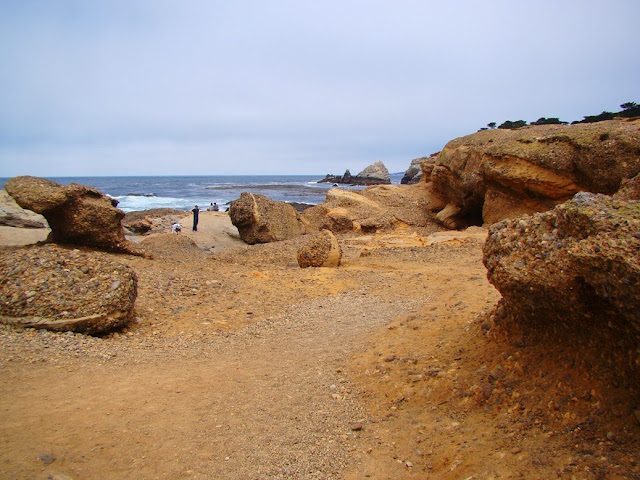
Garrapata doesn't quite have the prominence of Julia Pfeiffer Burns State Park, or Point Lobos. There are no visitor centers and no campgrounds, and in fact, few tourist facilities at any kind. No parking lots or admission booths. Just a table or two and some fine trails. It is pretty much a wilderness park, aside from the intrusion of Highway 1.

The coastal terrace at Garrapata was covered in wildflowers despite the late season when we visited. Above we can see an Indian Paintbrush. I'd try to identify it, wondering if it was the rare Monterey variety, but became aware that with more than 200 species, I probably wouldn't be successful at nailing it down.

The rocky coastline reveals some of the best exposures of the granitic rocks of the Salinian Block. I use the term 'granitic' because the petrologists who study igneous rocks are rather specific when they classify the light colored grainy plutonic rocks that normal people call 'granite'. The proportions of the minerals that make up the rock (quartz, orthoclase feldspar, plagioclase feldspar) determine whether the rock is granite, granodiorite, tonalite, diorite and others. On this part of the coast, the rock is identified as the porphyritic granodiorite of Monterey. Granodiorite contains a higher proportion of plagioclase than granite has. The term 'porphyritic' means that the rock contains much larger crystals of feldspar in a finer matrix of other crystals,

The rock formed as molten plutons deep in the crust. The rocks cooled slowly over thousands of years, allowing the crystals to grow to visible size. The granitic rock is monolithic while it remains at depth, but when it is exposed by erosion, the release of pressure allows the rock to expand. It does, but not like a marshmallow. It breaks into vertical and horizontal fractures called joints.

Ocean waves do a great job of exploiting the joints and fissures, tearing the rocks up and producing rugged sea cliffs and offshore rock islands called sea stacks.When waves impact against the rocks, they can exert pressure on the order of several tons per square foot, and air is compressed in fractures to the same degree.

Waves can widen joint systems, forming sea caves, like those seen below.. I don't know how far the caves at Garrapata extend, but some on the north coast are hundreds of feet long, and navigable by kayak.


The kid in me wants so badly to explore caves like these. I don't think the California coast had much of a history with pirates, but I could imagine treasures being hidden in the backs of some of these caves.


Garrapata State Park also exposes an excellent example of a nonconformity. Unconformities of all kinds are buried surfaces where erosion once took place. A nonconformity develops when plutonic or metamorphic rocks are exposed at the Earth's surface by erosion. Later, the surface was covered with sediments, in this case conglomerate deposited by streams flowing across the coastal terrace. Wave erosion later exposed the relationship seen in the photo below.
Terraces are not especially common along the Big Sur coast, but a modest one can be explored at Garrapata. Terraces result when the back and forth of wave action on a beach forms a more or less horizontal wave-cut bench. If sea level falls or the land rises, the bench is lifted above the wave zone to form a flat surface surrounded by coastal cliffs leading down to the water below. The terrace was covered with colorful vegetation due to the stable deep soils.
It isn't maybe fully recognized by most tourists, but every sea stack and small island on the California coast is part of California Coastal National Monument, established in 2000 by presidential proclamation. There are around 20,000 such rocks along the 1,100 miles of the California shoreline!
Our last little discovery of the day was a small waterfall that developed where Soberanes Creek flows across the coastal terrace and trickles into small cove. It was a colorful intersection of rock, water, and life.

Next stop: the point of the sea wolves!

Addendum: one of my Facebook friends pointed out what a terrible name Garrapata actually is: Tick. It reminds me of Avenida de Las Pulgas near Menlo Park in the Bay Area: the Avenue of the Fleas. It's really true: all place names sound better in Spanish!

Where the Sierra Nevada Rises From the Sea: Sea Wolves and Underwater Yosemites

$
0
0
Punta de los Lobos Marinos (Point of the Sea Wolves) is the source of the name of Point Lobos State Reserve, the next section of shoreline in our exploration of the most beautiful coastline in the world, the region between Big Sur and Bodega Bay in Central California. Point Lobos is one of the most popular of California's state parks, and so its inclusion in my little mini-series should be no surprise. Landscape artist Francis McComas once said that Point Lobos is "The greatest meeting of land and water in the world." I don't know that I completely agree, but that's only because of the nearby competition that I've already talked about in previous posts.

The sea wolves aren't land carnivores. The name instead signifies the elephant seals and harbor seals that frequent this section of coast. There have always been a few around when I've stopped in the area for a visit. And how ferocious they look!

There is a connection of sorts between seals (the Pinnipeds) and other large carnivores like the bears, canines, and felines. They shared somewhat of a common ancestry around 50 million years ago in a world much changed by the disappearance of the dinosaurs several million years earlier. Without major reptilian competition (although birds gave us mammals a run for our money), the mammals diverged quickly into several distinctive clans. Of today's carnivores they are most closely related to the bears or the Musteloids (otters, weasels, and skunks).
The title of the series invoking the Sierra Nevada grows from the realization that the rocks exposed along the coast in this region originated as granites of the Sierra Nevada Batholith. Subsequent shifts on the San Andreas fault system have carried these rocks, the Salinian Block, a minimum of 200 miles to the northwest, and possibly much more. In this sense, the Sierras do rise from the sea in the form of the Santa Lucia Mountains.

One of the wonderful features of the California Coast is how diverse the geology is. We've already seen in this series coastlines carved from volcanic rocks, metamorphic rocks, and granitic rocks. At Point Lobos there is something new and different: a colorful sedimentary conglomerate. The origin of the conglomerate allows us to draw one more comparison to the Sierra Nevada, although I admit the connection is tenuous one. Yosemite Valley is a deep 3,000 foot deep canyon with steep cliffs carved out of granite. Valleys carved in granite to depths of 5,000 feet with steep sides have also existed off the California Coast, and still exist today. They are not carved by glaciers, but by underwater landslides called turbidity currents.
Turbidity currents are masses of cobbles, pebbles, sand, and silt that break loose from the edge of deltas or continental shelves and flow as turbulent masses into much deeper water. Some turbidity currents travel at speeds of upwards of 50 miles an hour and as such have tremendous erosional ability. The Monterey Submarine Canyon offshore of California is as deep as the Grand Canyon, and is around 95 miles long.
55 million years ago, the Salinian Block was hundreds of miles to the south, and a submarine canyon was eroding at that time. The canyon filled in places with conglomerate and sandstone to become the Carmelo Formation which is found in exposures all around Point Lobos.
The pebbles include fragments of volcanic rock that  eroded from large volcanoes that once existed on the surface far above the deep masses of magma that made up the Sierra Nevada granites. I've never been much of a sedimentary petrologist, but I thought the conglomerates at Point Lobos were among the prettiest I've ever seen.
The sandstone exposures display interesting weathering patterns, like the cavernous weathering seen in the outcrop below.
And finally, a little biology. Not because I know what I was looking at, but because they seemed pretty.
There will be a bit more on Point Lobos in a coming post. If you want to visit, it is on Highway 1 a short distance south of Carmel Highlands. If you go, make sure to get an early start because the park is popular and the parking limited.

Need Geo-Pictures for that End of Semester Project? Check out Geotripper Images!

$
0
0
Active basalt lava flow at Kalapana on the Big Island of Hawai'i
Every so often I want to remind you all that I have collected a lot of my geology-themed photographs over at Geotripper Images (http://geotripperimages.com/). The pictures are available for free use in educational projects, either in student reports or by teachers in powerpoint presentations and the like. I would love to know that you've used a picture or two, and would even accept a tip, but the purpose is to be a resource. My only restrictions are if the photos are to be used in a profit-making enterprise, such as textbook photos or ads. Please contact me if you are interested in such uses.
Aerial view of Mt. St. Helens and Mt. Adams in Washington State
My whole reason for starting the Geotripper Blog six years ago was in part to make use of my burgeoning collection of geology-themed photographs taken during my journeys, and to telling the mostly geological stories of those journeys. After a few years, I realized the photos needed to be organized a bit more, so Geotripper Images resulted. A little research revealed that there are several other great geology photo sources on the net, so I linked to them in one of the boxes in the right column of the blog. Between Images and these other sites, you should be able to find pictures you need to finish that term paper on volcanoes, earthquakes and other earth science topics.
Saskatchawan Glacier in Banff and Jasper National Parks, Alberta, Canada
We've accumulated a few pictures of living creatures, so don't forget to check for animals that you might need. My work schedule means that additions are sporadic, but I'm intending to add a lot of shots in coming weeks as the semester winds down.
A normal fault in Mosaic Canyon, Death Valley National Park, CA
Writing this blog post reminds me of how lucky I have been to be able to explore as much of the world as I have. It's been a blessing, and I hope you enjoy the stories and the views. I also hope that you are encouraged to get out and explore a little more of the Earth that we live on. It is a fascinating place!

Have a good Thanksgiving holiday!

Where the Sierrra Nevada Rises From the Sea: A Quick Explore of the Monterey Peninsula

$
0
0
We've been exploring the most beautiful coastline in the world, and in the last post we were looking at a spectacular conglomerate, the Carmelo Formation, which formed in submarine canyons off the coast of California. The rocks exposed in the cliffs formed in the Sierra Nevada magmatic arc, but were sliced off and moved north along the San Andreas fault some 200 miles or more. Today we finish at Point Lobos and briefly explore part of the Monterey Peninsula.
The south end of Point Lobos includes China Cove and a beautiful sea arch with jade colored water. Jointing in the granitic rock allows the waves to exploit weaknesses to form coves, and arches can form along narrow headlands. Once formed the arches will increase in size until they collapse, isolating the headland as a sea stack or small island. It takes only a few feet of deep water to protect an island from terrestrial predators, so birds will nest there. In July the Brandt's Cormorants formed large groups that made me imagine penguins near Antarctica. The white bird droppings complete the illusion, resembling snow!

As we headed north along the highway, we encountered Seventeen Mile Road on the Monterey Peninsula. It is a toll road, passing through lots of private neighborhoods, but the appeal of the road is undeniable, so I will grant them a bit of free publicity. Where the cliffs at Point Lobos tended to be broken up by the stresses of nearby fault zones, the rocks on the peninsula are more solid, and wave erosion accents the joint patterns in the granitic rock.

Two unique species of tree grow on the Monterey Peninsula, the Monterey Cypress, and the Monterey Pine. Both of them have a very limited native range, the Pine in five groves along the coast, and the cypress in only two, at Point Lobos and Cypress Point on Seventeen Mile Drive. Although I refused to take a picture of it, a huge cypress on a headland along the drive is one of the most famous trees in the world. The poor tree has had all manner of wires and cables attached to keep the tree standing, and cement walls protect the base. I just sort of feel like the poor thing is abused, kept alive by extraordinary measures instead of letting nature do her thing.

The cypress trees, both alive and dead, make a marvelous counterpoint to the white granitic boulders along the coastline.

The Monterey Pine is the most widely planted commercial pine in the world. Some 10 million acres across the globe, especially in Australia and New Zealand, have been planted and are producing lumber. Most people would be surprised to learn just how limited the original forest is, just two islands off of Baja Mexico, at Cambria and Ano Nuevo on the California Coast, and on the Monterey Peninsula.

A large swath of forest has actually been preserved as a more or less wilderness grove, quite a surprise given the private landholdings. Developments still threaten the forest, but even worse is a fungus (pine pitch canker) that is killing large numbers of trees. It would be tragic to lose the trees, as the natural stands possesses far more genetic diversity than the plantings around the world.

The toll road climbs to a high point that offers views of the coast north of Monterey (when there is no fog). It was a pleasant drive through this uniquely Californian forest.

There is a fine description of the evolution of the Monterey Pine at http://evolution.berkeley.edu/evolibrary/article/montereypines_01, and an article on the Monterey Cypress at: http://www.pointlobos.org/nature/plant-communities/monterey-cypress-evolution. It makes interesting reading!

Up next: we jump across the Golden Gate!

What Creature of the Great Valley Could Have Snacked on Velociraptors? This one...

$
0
0
I apologize for the quality of the photographs today; they are from my phone, which is all I had when our latest display specimen arrived in our department. It's an exciting addition to the collection. We have been making a concerted effort over the last decade to raise the quality of science education in our impoverished community, an effort supported by our community with the passage of a bond act that brought about the construction of the Science Community Center at Modesto Junior College. The facility is wonderful, with a new planetarium and a fully operational observatory, as well as a vastly expanded Great Valley Museum.

My goal during this decade long project has been to increase the recognition that our county has a rich history of discovery in the field of paleontology. The first dinosaur ever found in California was discovered in our county in 1936. It was a hadrosaur, a duck-billed dinosaur, and we are still awaiting the arrival of a specimen of that creature in our department.

But what arrived today was one of the most fascinating creatures to ever come out of the sand and silt of the Great Valley Group: a mosasaur. The mosasaurs were some of the most fearsome sea creatures of the Mesozoic era. They were not dinosaurs, but instead were more closely related to large lizards. The middle skull is our recently acquired short-faced bear (Arctodus simus), one of the largest carnivorous mammals ever to exist, while the dinky little skull on the right is an accurately scaled velociraptor!
Mosasaurs arrived late on the scene, during the mid-Cretaceous Period, possibly occupying the environmental niche of the recently extinct Ichthyosaurs which had dominated the Mesozoic seas since Triassic time. Mosasaurs resemble varanid lizards (like the Komodo Dragon) and the various species ranged in size from about 10 feet (3 meters) to as much as 57 feet (17.5 meters).

The young man who discovered the first dinosaur in California, Al Bennison, also discovered the first mosasaur in our state. As it was an entirely new species, it was named Plotosaurus bennisoni. His specimen was probably about 30 feet long. Not long after an even longer species was discovered, Plotosaurus tuckeri, which measured over 40 feet in length.

I wanted a display specimen that could communicate to the young visitors in our museum and Science Community Center the excitement of the paleontological heritage of the region they live in, and having a four foot long skull of a mosasaur will go a long way towards achieving that goal. It arrived today and I was thrilled to see it. Just the same it was a terrifying creature. If it had you in its jaws, you weren't going anywhere. If you look in the picture below, you can see a second set of teeth in the back of the jaw. It was literally like something from the Aliens movies.

The specimen, from Taylor-Made Fossils of Missouri, is not a Plotosaurus, but will suffice to show what the Mosasaurs were like. The definitive source of information about the California mosasaurs is the book Dinosaurs and other Mesozoic Reptiles of California by Richard Hilton (who taught at MJC for a time; he is currently at Sierra College). The illustration below is a scan of his idea of the appearance of the Plotosaurus bennisoni.
From Dinosaurs and other Mesozoic Reptiles of California, by Richard Hilton

If you ever are passing through the Modesto area, be sure to stop in on the west campus of Modesto Junior College and wander through the Science Community Center. Even though the museum is not slated to open for a few more months, there are many other displays throughout the complex, including our new seismometer, and very soon, a mosasaur skull on the third floor in the geology area!

The Looming Volcanic Giant of Northern California: Mt. Shasta

$
0
0
So California is all about earthquakes, right? Oklahoma has tornadoes, Florida has hurricanes, Minnesota has blizzards,and California has the San Andreas fault (and all the other active faults that no one seems to remember the names of). But really, California has a "little" of everything, and we have a "big" of volcanoes. I was on my way home today from family Thanksgiving celebrations in Oregon, and while we traveled down Interstate 5, we had some simply awesome views of California's gigantic volcano, Mount Shasta.

Shasta is the second tallest volcano in the Cascades Range at 14,179 feet (4,322 m) after Mt. Rainier, but in bulk it is the largest composite cone/stratovolcano in the range (Medicine Lake Highland, also in California, has more volume, but is a shield volcano that doesn't even reach 8,000 feet in elevation). The mountain is composed largely of andesitic lava flows and ash deposits, but also includes outpourings of basalt and dacite. It has been active for more than half a million years, and may have last erupted in 1786. It has had eruptions on average every 600 years or so, making it the second most active volcano in the Cascades after Mt. St. Helens.
Shasta is a composite cone in the truest sense. At least five distinct volcanoes in various stages of disrepair make up the mountain. The earliest collapsed around 350,000 years in a gigantic debris avalanche that flowed 28 miles north to the vicinity of Yreka (the nature of the slide was not recognized until the 1980s after St. Helens produced a similar avalanche with a length of 12 miles). The Sargents Ridge and the Misery Hill cones erupted, became dormant and were deeply eroded by glacial activity. Shastina erupted around 9,800 years ago forming a large satellite cone that is actually the third highest volcano in the Cascades. Hotlum Cone is the currently active volcanic center, having erupted fairly often during the last 9,000 years.
Shasta has seven active glaciers, including the longest and most voluminous in California. Meltwater from the glaciers will occasionally cause destructive lahars or volcanic mudflows. Other dangers lurk on the flanks of the volcano, where some 20,000 people live. Ash flows, lava flows and even a caldera collapse are possible hazards to those who live in the shadow of the mountain.
The mountain is famous for mythology and legends as well. The native Americans certainly understood the power of the mountain, having witnessed some of her eruptions. The prominence of the giant edifice has resulted in all manner of speculation about the gods and aliens who call the mountain home. Many consider the mountain to be a "global power center" or "spiritual energy vortex". The existence of the mountain alone makes it magical for me, but folks seem to take this stuff seriously. I was in a crystal shop this afternoon listening to a strange and earnest conversation about chemtrails and spiritual vibrations. Books abound about the Lemurians and other societies that live inside the volcano. They've got it all figured out...

Shasta is a beautiful mountain, and a looming volcano that is capable of creating havoc. On this particular day, all was peaceful and serene. We enjoyed the sight during our long journey.

Darlingtonia: A Horror Story in Sand and Serpentine

$
0
0
...the trail through the forest began innocently enough. Greenery was everywhere. The travelers were hungry, driven by a need for food, a need so bad they could smell it. They drove deeper into the dark shadows. They began to be aware of a pervasive odor, an odor that awakened memories of delicious feasts from the past. Something was out there in the dark shadows.

There was an opening. The splendid odor of food wafted from inside. They were so hungry, they were driven to see what was in the opening. There were some strange fibers about their feet, but the smell of food was overpowering their sense of caution. They crept further inside, becoming vaguely aware that the floor beneath their feet was becoming slippery. The entrance was now out of sight, but they didn't worry, they could see openings that would allow them to escape if necessary. They started sliding deeper into the cave, and they became alarmed. They decided they were in danger, and climbed towards the openings only finding to their increasing panic that they were transparent windows, not exits. They could not escape! Where was the opening? It was gone. 

A pool appeared below. A pool filled with the digested remains of previous travelers. The travelers realized their peril and tried to climb back up but downward pointed spikes prevented them from doing so. They struggled, exhausting themselves as they fell deeper into the abyss...
And such is the terrifying drama that was recommended to me by Lockwood when he found I was headed to Florence, Oregon for Thanksgiving. Of course the travelers were insects, not humans, and their terrifying trap was a Daringtonia californicus, also known as the Pitcher Plant or the Cobra Lily. The plant grows in northern California or southern Oregon, in two completely different environments: sandy coastal bogs and serpentine soils. In both environments nitrogen is limited and the plants get it by capturing and digesting insects.
They're looking at you...
The Darlingtonia Botanical Wayside is a small parkland of 18 acres about five miles north of Florence, Oregon in a bog formed in the hollows of coastal sand dunes that have been stabilized by the growth of a thick forest. It's a pleasant little stop, and given the nature of the plants in the bog, maybe free of mosquitoes? Maybe not at other times of the year...it was pretty cold the day we were there.
They're discussing you...
They have a flower that blooms during the spring, which I will need to check out. Here on the last day of November they were dying back for the winter, but plenty were still out and about.
They're all looking at you and sizing you up. Be scared. Be very scared...
The small section of forest in the park was also beautiful. I haven't been in the area enough to start recognizing the species just yet. Cedar or spruce?
If the Darlingtonia doesn't get you, maybe the tree trolls will instead...
 This is an area that I will need to explore some more!

Where the Sierra Nevada Rises From the Sea: Half Moon Bay

$
0
0

There was a time when the seas lapped against the Sierra Nevada foothills. Around 50 million years ago, the Great Valley was a shallow sea trapped between the western edge of the North American continent and a huge subduction zone that was carrying ocean crust, seafloor sediment and assorted volcanoes back into the crust and down into the mantle. The Sierra Nevada Mountains as we know them today didn't exist. At most there were low hills and a long slope that led to highlands in central Nevada. Vast rivers carried sediment into deltas and swamplands along the coastal complex. The resulting layer in the Sierra foothills is called the Ione Formation. It is related to the Domengine Formation found in the Coast Ranges along the west side of the valley.

Half Moon Bay is a bit different than the other coastal regions we've visited in my little mini-series on the most beautiful coastline in the world, the stretch between Big Sur and Bodega Bay. The mountains above the coast at Half Moon Bay don't rise so abruptly as they do further to the south. I can look at the coastal terraces and low hills and imagine a scene that is reminiscent of the Sierra in the time of the Ione. Except for the jungles. There are no jungles here. The presence of coal seams and fossils of palm trees suggest that the Sierra Nevada looked more like the Yucatan Peninsula of Mexico than any place in California. Still, the hills above the coast have extensive exposures of Sierra granite that has been carried hundreds of miles northwest along the San Andreas fault over the last 20-30 million years.

The fairly muted terrain along this stretch of coast displays some really fine examples of geologic structures and coastal erosion features. In the cliff shown in the picture above at Miramontes Point, one can see the tan colored gravels and sandstones of the coastal terrace, but underneath are tilted layers of the Purisima Formation, a gray silt-rich deposit. The Purisima was deposited as horizontal layers, but subsequent faulting and tectonic activity caused the rocks to be pushed and eroded before being covered by the terrace sediment. This type of contact is called an angular unconformity.
The most intense wave erosion in a beach environment is going to be directed at headlands, the rocky points that stick out into the sea. Conversely, the least wave action occurs within the protected coves. As a result, sandy beaches accumulate in the coves (as in the picture above, and sea stacks (small rocky islands) predominate just offshore of headlands (such as in the picture below at the Ritz-Carlton).

The Ritz-Carlton is a bit rich for my taste (~$500/night), but the beach is free by state law. It's a beautiful place to wander.

There are some nice tide pools in the bedrock exposures, and low tide brings many small discoveries. Snails, clams and octopi are related families within the phylum Mollusca. They are descended from a common ancestor that may have resembled the chiton, the creature with the segmented shell in the middle of the picture below. A chiton can be thought of as a snail with a flat segmented shell instead of a coiled shell. Or it could be thought of as a half clam, with just a top shell (and biologists everywhere want to yell at me now).
The terraces and sea cliffs of Half Moon Bay result from uplift along local faults that has raised former wave-cut benches out of the surf. In other words, waves once rolled across the flat areas at the top of the cliffs. Undercutting of the slopes by relentless wave action maintains the vertical cliffs and cliff retreat can measure in inches or feet per year (be careful how you site your beachcliff home!).

It isn't just the cliffs. The coastal lowlands just north of town have been suffering from wave erosion, and some shoreline roads have to be reinforced with riprap, large boulders used to absorb wave energy. We've watched severe storm waves splash on the front windows of one our favorite restaurants in the area.

There is one other thing I would love to see some day in the Half Moon Bay region. One certain days of the year when the offshore storms are just right, the configuration of the seafloor off of Pillar Point (below) causes the production of monumental waves that can exceed 50 feet in height. The so-called Mavericks are legendary, and when they are crashing, a major surfing competition is organized.


You Mean That Aliens Didn't Do It? New Research on Mima Mounds in the American West

$
0
0
Mima mounds south of Seattle, Washington
What's life without a little mystery? For years, geologists and geomorphologists have been curious about a landscape that shows up on prairie lands around the American West. It's a regular pattern of low hillocks called mima mounds. The hills are a few feet high and a few dozen yards across. They generally occur where there is a clay substrate that sometimes causes pools to collect between the mounds. These are called vernal pools, and for the few months that they hold water, they support a large variety of unique plants and animal species.
Mounds in the Yokohl Valley region in the Sierra foothills near Sequoia National Park.
The mima mounds are a mystery because their origin is not exactly clear. Early settlers thought they were burial mounds for Native Americans, but that is not supported at all by archaeological research. Some have suggested that they result from disruption of the soil by earthquake waves. The mima mounds I photographed from above (first picture) were in Washington near the margins of the vast continental glaciers, and some have speculated that they formed as a result of meltwater flooding in some fashion. Other less scientifically oriented observers suggest that aliens from space have something to do with their formations (landing pads, maybe?).
Mima mounds near Willms Road in the Sierra Nevada foothills near Knights Ferry on the Stanislaus River.
Of course, some people suggested that the origin might be a bit simpler (remembering Occam's Razor: among competing hypotheses, the hypothesis with the fewest assumptions should be selected). They suggested generations and centuries of activity by ground squirrels or gophers resulted in the formation of the mounds. In the prairie environment, the mounds would give the rodents a better view of approaching predators, and their burrows would stay drier, being above the impermeable clays.

I was pleased to run across some current research on the origin of these enigmatic mounds by Manny Gabet at San Jose State University, and the verdict is...gophers. Generation after generation of gophers, building their mounds in the same place over time. Gabet doesn't insist that this is the absolute explanation for all mounds, but the computer modeling provides strong support for the idea. The mounds would develop after around 500-700 years.
Snow patches outline mima mounds at Tehachapi Pass in southern California (photo by Mrs. Geotripper).

Sorry, alien lovers...maybe Roswell has some new evidence.

Little Boxes on the Hillside, Little Boxes Made of Ticky-Tacky...The Mess at Mussel Rock and the San Andreas Fault

$
0
0
Little boxes on the hillside,
Little boxes made of ticky tacky
Little boxes on the hillside,
Little boxes all the same,
There's a pink one and a green one
And a blue one and a yellow one
And they're all made out of ticky tacky
And they all look just the same...

Malvina Reynolds (1962)
Photo by Mrs. Geotripper

The next beach on our journey along the most beautiful coastline in the world may not actually be the prettiest beach ever, but there is a lot going on here. Mussel Rock lies along the coast between Pacifica and Daly City, and a high cliff of really unstable looking rock slopes precipitously towards the waves. Some of the terraces in the photo above are the remains of an old alignment of Highway 1, and an earlier railroad track. Of course no one would ever be so foolish as to build houses in such a place? Oh, wait...
Photo by Mrs. Geotripper
There are little box-like houses up there! And some of them aren't up there anymore. A number have tumbled down the cliff face over the years. There is also a garbage dump that was active from 1957-1978 and is now threatening to slide into the ocean. Wave action keeps undercutting the slopes below the dump (I don't call it a sanitary waste disposal facility, because it isn't sanitary; it isn't lined, so all manner of pollutants can leak out too). All in all, it is a pretty good example of how many ways we can abuse a coastline. And yet it still has a certain beauty.
Daly City has never really figured out how to deal with the mess at Mussel Rock. They've finally decided to call it a park, but it has never been developed other than to have a small parking lot. It's kind of a sad missed opportunity because Mussel Rock has another incredible distinction. The San Andreas fault passes along the base of the cliff and heads out to sea at this locality. The epicenter of the 1906 San Francisco Earthquake was probably just offshore of the point. The actual Mussel Rock is composed of Franciscan Complex rocks, while the unstable cliffs are composed of the Merced Formation, a collection of sandstone and siltstone that was raised from the sea in geologically recent time. On the one hand, Daly City may not want the notoriety of being the origin of a quake that destroyed the City By the Bay, but it sure is a great opportunity to educate people about California's most prominent fault line. Shane Heiser has written an extensive history of the site that proposes developing the beach as an educational park and protected habitat for the rare San Francisco Garter Snake.


The actual fault trace is obscured by the landslides. In the picture at the top of the post, one can see the distant Point Reyes Peninsula on the horizon. The San Andreas comes on land again at the low pass on the left in the far distance.

The song "Little Boxes" was a folk anthem from the early 1960s written by Malvina Reynolds and also sung by Pete Seeger. It decried the rigid conformity of the day, and was inspired by the very homes you see on the cliffs above Mussel Rock. The houses do have a sort of cookie-cutter aspect.

Here's a Totally Unfamiliar Sight: Some Call it the Golden Gate

$
0
0
We are continuing our exploration of the most beautiful coastline in the world, the shoreline that runs from Big Sur to Bodega Bay. Today we'll have a look at one of the best-kept secrets of the entire state of California.

One of these times, you might find yourself in the city of San Francisco. It's a beautiful city built on a number of hills on the San Francisco Peninsula with a gorgeous stretch of beach, and a complex mix of rocks and sand dunes. If you do visit the city, try and take the time to seek out one of the unknown wonders of the city. As early as 1917, talk began of building a bridge across the opening of San Francisco Bay to the Marin Headlands. Much to the surprise of many visitors to the city, the bridge was actually built in 1937, providing a quick shortcut to the Sonoma/Napa Valley region, another part of California that no one has heard much about.
Locals call the span the Golden Gate Bridge. They try and keep it a secret from the tourists, fearing that it might get crowded and clogged by traffic. But if tourists are persistent, they can navigate their way through the back streets and find the bridge. Be aware that there will be people at one end collecting money from gullible drivers, insisting that they are simply charging a "toll" to use the bridge.
The bridge as seen from Fort Baker on the north side.
Oh, heck, I don't know how long I can drag this joke out. The bridge is only one of the most famous spans in the world and one of the most iconic symbols of California. Still it is a wonder to see, and I can't resist stopping whenever it comes into view. The setting is spectacular with steep coastal cliffs, the beautiful skyline of the City by the Bay, and the dark forests of the Presidio. When built, it had the longest span of any suspension bridge in the world at 4,200 feet, and is still the second longest in the United States. It rises nearly 250 feet above the waters of the Golden Gate. The two suspension towers are 746 feet high. A small army of thirty eight painters works continuously to protect corrosion-prone surfaces. And then there is the fascinating geology...
The bridge from the Marin Headlands.
San Francisco Bay is one of only two natural harbors along the California coast, and for two centuries has been a critical transportation and trade corridor for the state. Rivers that drain 40% of the state of California flow into the bay. It originated only 8,000 years ago as the last major ice age ended and sea level rose to flood the lower Sacramento River Valley (There were no doubt previous incarnations of the bay during earlier interglacial periods). During the ice advances sea level would drop three hundred feet or more, and the Sacramento River would flow to a delta near the Farallon Islands more than twenty miles offshore. Despite the urbanization, the bay is one of the most important estuary-wetland environments on the entire west coast of North America.
Several important fault systems cut across the Bay Area, including the well-known San Andreas, but also the less familiar Hayward, San Gregorio, Calaveras and many others. The proximity of these faults to the bridge is cause for some concern to the engineers who desire that the bridge would survive a major seismic event (retrofits have recently been completed). Part of the problem is the that the southern abutment is situated in serpentinite, a notoriously unstable rock (the cliff just visible on the right of the picture above is Baker Beach, which is made up of numerous landslide blocks).
The Golden Gate as viewed from the summit of Mt. Diablo in the east bay region.
The geology is incredibly complicated. The hills are composed of exotic terranes in the Franciscan Complex, bits and pieces of continental and oceanic crust that were carried hundreds or thousands of miles from their point of origin and accreted to the western edge of North America along a vast subduction zone. The subduction zone changed to a transform plate boundary (lateral movement along the San Andreas fault) only in the last few tens of millions of years.
Source: National Park Service

The rugged cliffs of the Marin Headlands (seen in the picture below from Fort Point) will be the subject of a follow-up post soon, but in short they are made of a complex mix of ocean floor basalt and reddish chert, a quartz-rich sedimentary rock that formed originally on the sea floor as diatomite. The diatomite was composed of trillions of microscope shells of one-celled creatures called (you guessed it) diatoms. The rock forms a solid foundation for the northern bridge abutment.
As mentioned already, the foundation of the southern abutment is in serpentinite, a far less stable rock (seen below from Baker Beach). You can see the landslides on the right side of the picture. I probably had a chance of being arrested the day I took the picture. It was September 15, 2001, just a few days after the tragedy of the Twin Towers and Flight 93. We were on a field trip with the National Association of Geoscience Teachers that had almost been cancelled. Airlines were not yet flying, and security around iconic symbols around the country was very tight. I imagine that if we had wandered closer to the base of the bridge there would have been trouble, or at least some very pointed questions from the California Highway Patrol.

Inside the Biggest Cavern Opening in California: Moaning Caverns in the Sierra Nevada Foothills

$
0
0
Yes, I had another field trip today! It was less academic then some, as it was a Geology Club tour, but learning was part of the experience. We headed into the Sierra Nevada foothills to check out some karst topography, visiting Moaning Caverns, and exploring Natural Bridges at New Melones Reservoir. I'll cover the Natural Bridges in a separate post later on.

Moaning Caverns has one overwhelming distinction: it has the largest underground opening in California. The 180 foot tall main room could actually fit the Statue of Liberty (but good luck getting it through the narrow cave opening)! There are other interesting features, but size is everything here. I've been to Carlsbad Cavern, and it is in a class by itself, but I've also been in many caves in California, and none has a room to match this one.
I'm proud to say that one of our geology majors served as our guide at the cave tour today. She did herself proud. The tour starts around the historical cavern entrance, and it wasn't a historically great place to discover a cave: it has a vertical drop that with a few wall collisions totals around 170 feet (the guides call it the 7-second tour). Animals and humans have stumbled into the cave many times in the past, and many bones have been discovered in the bottom, including a human skull said to be 12,000 years old (I'll have to ask some anthropologists for a judgement on that one). Some of the bones are displayed in the glass cabinet in the picture above.
The cavern has been known for a century or more, and tours have been offered since the 1920s. The difficulty of the original entry has been circumvented by blasting a narrow passageway and the installation of stairs. Lots of stairs. I've been exercising a lot in recent weeks and yet my legs were rubbery by the time I got to the top!
The base of the stairwell is a platform that allows a view down into the main room. It's hard to get a true perspective of the size, and our guide pointed out that features we thought were a few tens of feet away were actually more than a hundred.
It's kind of fun to have our guide narrate the tour while dangling from a rope a hundred feet above the base of the main room. Serena displayed a flair for the dramatic! We tourists took the alternate route, a circular stairway 100 feet high that was welded from fragments of a World War I battleship in about 1922. What's more scary, a 165 foot rappel, or trusting a ninety year old iron stairwell that has been in a humid environment the whole time?
 It's a thrill ride either way!
 From the bottom of the stair, we could look up at some of the excellent speleothems (cave decorations). There was a twenty or thirty foot high stalagmite...
And an IMMENSE flowstone feature called the Chocolate Fall. I've never seen anything like quite like it anywhere else. It seemed to extend halfway up the wall of the main room.
It is very difficult to discern the scale of the room in a photograph. Below, you can see the stalagmite and Chocolate Fall in comparison to the circular stairwell. 
And here is a shot from near the top of the circular stairwell, looking straight down. Those little dots are some of my students still exploring the bottom of the cave.
Moaning Caverns offers a standard walking tour (what we did), and a more extended adventure tour that explores additional rooms below and around the main chamber. Some lower passages haven't been explored in years. The vertical nature of the cave means that carbon dioxide can accumulate to dangerous levels in the deepest portions.

One can also rappel. Um, no thanks, I'll take a rain check.

The owners of the caves are quite decent about providing discounts for student groups. They can be contacted at http://www.caverntours.com/MoCavRt.htm.
Next, an adventure in the Natural Bridges...

PS: "Moaning"? I didn't talk about the name, did I? They say today that it is from the particular way that dripping water echoes off some of the rocks, but I remember hearing (this isn't hearsay at all!) that the pressure differences caused a very strong airflow through the original entrance that would whistle and moan like a ghost. The development of the cave nearly a century ago destroyed the effect.

The Sierra Nevada Underground: Natural Bridges of Gold Rush Country

$
0
0
In our last post we had a look at one of the showcase caves of the Sierra Nevada, Moaning Caverns. They are well-known, if for no reason other than the billboards along Highway 99, and the leaflets in restaurants all over the region. And the cave is spectacular. Far less known are some cavern features just a few miles away as the crow flies: Natural Bridges.

Most people hearing the name will think of Natural Bridges State Park on the beach in Santa Cruz. The caves we visited are a long distance from the coast. They are located on the upper reaches of Coyote Creek, a tributary of the Stanislaus River that drains into New Melones Reservoir near Columbia State Historical Park. It's in the middle of the Mother Lode Gold Rush country.
The bridges are at the end of a hike of about a mile on a good trail, although we were surprised by a bit of mud and snow on the trail last Saturday. It was slippery in a few spots, but we got down the hill okay.
There are two bridges that span Coyote Creek. I thought for a long time that the creek had breached a cavern below the river bed, and that erosion had carved the openings below the bridges. The facts are a bit more complicated. There was a canyon first (no caverns), and a set of springs that emerged from the sides of the canyon. The springs were full of dissolved calcium carbonate, and as the water evaporated, calcite deposits, called travertine, were left behind. They perhaps would have resembled Mammoth Hot Springs in Yellowstone National Park. The springs grew larger and larger, and eventually spanned the creek. Somewhere along the way, the water breached the base of the springs and flowed through, and even eroded into the underlying marble.
The creek usually has a modest flow, although I've read of flash floods that backed up and flowed over the top of the upper bridge. The water has pooled under the bridges, in some places 7-8 feet deep. In warmer weather, visitors will swim or float inner tubes through the caves. Last Saturday, we looked at the snow, and most of us chose to stay dry. It is possible though to explore several yards into the caves on dry rock.
The lower entrance to the main bridge/cave is wide with a large clear pool of water. In the afternoon, the sun reflects off the surface and shimmers on the roof of the cave.
Some of the springs that formed the travertine are still active, and pour into the pool from the ceiling of the cave entrance. There is a constant chorus of dripping and pouring water.
After exploring the upper cave, we made the somewhat more complicated trip downstream to see the lower bridge. There is a trail, but it climbs the south slope in a few seemingly illogical spots (although trying to bushwhack through the "shortcut" soon convinced us otherwise).
Around a third of a mile downstream, the lower bridge comes into view. Like the upper bridge, the water has ponded inside, requiring a swim or float to get through. There are rock ledges that provide dry access for some distance into the upper entrance.
Both of the caves show the effects of decades of visitation and occasional examples of wanton vandalism, but plenty of features remain, especially those that are out of reach in the darkness above. Since the construction of New Melones Reservoir, the caves fall under the jurisdiction of the Bureau of Reclamation, so the caves have some degree of protection, and the area was free of trash and garbage when we visited.
Maps and description of the trail can be found at http://www.usbr.gov/mp/ccao/newmelones/planning_visit.html#hiking. Parking is provided along an older route of Parrots Ferry Road a few miles north of the Gold Rush town of Columbia. It can also be accessed from Vallecito on Highway 4. There is a vault toilet at the trailhead, but not along the creek. The trail is particularly beautiful in the spring when the wildflowers bloom.

CREC, the Basin and Range, and Sunsets: On the Lower Colorado River

$
0
0
Although there is some geological discussion going on here, this series of photos is really an excuse to share an extraordinary sunset that I enjoyed yesterday evening. Sometimes a sunset is spectacular in its own right, no matter where one might be (my home in the Great Valley being a rare example). Sometimes, though, the landscape and the geological forces that produced it become part of the sky show. That's how it felt yesterday.
It had actually been a gloomy overcast day as we traveled from the Phoenix area to Laughlin, Nevada, with only a bit of sunshine breaking through now and then. Laughlin is of course the small casino strip that provides an alternative to Las Vegas. As a casino town it has the bright lights and giant billboards, but lacks the level of crime and grunge. It has very cheap but reasonably nice rooms ($24 on a weeknight!), and it sits on the shore of the Colorado River. I'm not like a lot of people...I didn't lose any quarters to the one armed bandits because we were there for the room, being a nice overnight break from the long drive home.

We came up from Phoenix on Highway 93 through Wickenburg and Kingman. From Kingman we headed west across Highway 68 through Golden Valley, and over Union Pass in the Black Mountains. We were not far from the edge of the Colorado Plateau (the Grand Wash Cliffs are north of Kingman), and were headed into the interior of the Basin and Range geological province.
The Basin and Range is one of the larger geologic provinces of the United States, extending across all of Nevada, much of Arizona and Nevada, and the eastern part of California. It is a part of the Earth's crust that has been stretched quite literally to the breaking point. Hot upwelling mantle material had raised the landscape and stretched it not unlike the crust on a baking loaf of bread. The solid crust and upper mantle fractured and split, forming major systems of normal faults and near-horizontal detachment surfaces. The land broke into large mountain ranges (horsts) and deep fault valleys (grabens). Ancient river systems were broken up, and with the exception of the Colorado, no rivers flow out of the region to reach the sea. Most of the valleys are interior drainages, ending in playas (dry lakes).

The Colorado River is a strange one all on its own. The upper reaches of the river have been in place for tens of millions of years (dinosaurs may have roamed some of the most ancient canyon passages), but the gorge of the Grand Canyon has probably existed for no more than 6 million years (researchers are still arguing), and the passage to the sea in the Gulf of California for only 4 million years. There have been some wholesale changes in the pathway followed by the river, with the details a great mystery, although more is learned each year.

The valley of the Colorado River at Bullhead City and Laughlin is a heritage of the tectonics of the Basin and Range Province. The river did not carve the valley. It instead flows through a valley that developed from the extreme extensional faulting that formed this part of the province. The researchers in this region call it the Colorado River Extensional Corridor, or CREC.
The upper mantle is a region in the Earth's interior a hundred or so miles down where it is hot enough to melt rock, except for the extreme pressure the prevents the melting from taking place. One of the consequences of extreme extension is that pressure is released on the upper mantle, and some partial melting occurs, forming bodies (or plutons) of hot magma. Volcanism is thus a constant geological phenomenon in areas of crustal extension. We were crossing the Black Mountains, which are mostly composed of exposures of ancient schist, gneiss and granite. But at Union Pass, there are numerous exposures of light colored rhyolite.

Rhyolite can be a violently explosive material depending on the gas content of the magma. One of the eruptions in the immediate region produced the Peach Springs Tuff, an ash layer that coated the landscape from Barstow California to Peach Springs Arizona, with around 150 cubic miles being extruded in one eruptive sequence. Numerous other eruptions rocked the region from about 16 to 19 million years ago (a new geologic map of the area was published this year if you want to take a look).
So what does the landscape have to do with beautiful sunsets? Maybe not much, but here are some ideas: the Basin and Range is a hard place to live. Behind the rain shadow of the Sierra Nevada and Peninsular Ranges of California, the region is the nation's driest. Aside from the aberration of Las Vegas, there are few large towns and consequently few sources of air pollution. The air masses that move across the region are constantly encountering mountain ranges and thus rise and fall, leading to instability of the wind currents. It's rare, I imagine, to see stratus clouds blanketing the region as they might do in flatter places. And finally, the high mountains provide a vantage point from which to see horizons that might be more than a hundred miles away.
 So it was that we came over Union Pass in the Black Mountains at the end of a long day, expecting more of the gloomy overcast that we had seen all day. That's not what we got. As we started down the long grade to the Colorado River, a sliver of sunlight broke through the clouds on the western horizon, and the rhyolite cliffs seemed to catch fire from within.
I found a gravel road on the south side of the highway and we climbed to the top of the ridge to catch the light show. For a few brief moments a sun pillar lit the sky across the valley from us (below).
As the yellow and golden light faded, we got in the car and started down the highway, only to see the sky light up again in bright crimson and magenta. We stopped again in front of a new housing development on the highway.
The colors were stunning. Even the locals were impressed; our waitress at dinner saw some of these pictures on my laptop and commented how gloriously the evening had ended.
I used the zoom lens to concentrate on the most distant horizon, catching a sky that had seemingly caught fire. After a few moments the colors faded and we headed down the hill, back to habitations of humans.

Desert Skies, Hoodoos, and Really Big Rhyolite Explosions: An Innocent Abroad in Phoenix

$
0
0
Some places I don't know very well in the geological sense, and this makes no sense, because I've been in Phoenix a lot over the years. Oh, I glance at the guidebooks, but invariably my brother will get up and say "let's go explore (fill in a feature in any direction from Phoenix)", and it will be some corner of the landscape I've never seen or read about. And so it was that we headed southeast last week towards the towns of Superior and Miami. The legendary Superstition Mountains rose to the north, and we ended up driving through the heart of the Pinal Mountains.
The Superstitions are the home of the Lost Dutchman Mine, which was not exactly lost, and no Dutchman was associated with it, but people look for it anyway. I have a strong feeling that it was found a long time ago, and was mined under a different name with no one the wiser. There wasn't a lot of mineralization up high in the mountains, but a fair amount around the margins, and those areas were exploited a long time ago.

Copper was another story. Vast deposits have been found throughout the area, and Superior, Miami and Globe grew with the mines. I liked the street sign in downtown Superior (below). Magma was the name of one of the mines in the area. Still, it would be nice to see more geologically themed street names in my local town...
We drove east of Superior into the Pinal Mountains and soon encountered some very rugged territory. Although I was ignorant of the fine details, I quickly recognized that we were in the vicinity of some heavy-duty Neogene rhyolite calderas (that's "supervolcanoes" for the Discovery Channel writers). There were at least five calderas in the region. Each one was capable of producing massive explosive eruptions of hot ash in volumes exceeding 100 cubic miles. The pink rocks forming the cliffs around us are called rhyolite tuff which formed when the hot ash hit the ground and re-melted, but quickly cooled and solidified into rock.
I never get tired of photographing the saguaro cacti that are endemic to this region of Arizona. They seem to have unique personalities, if plants can have personalities.
The pinnacles of rock formed as the ash cooled and contracted. The ash flow had to shrink and so formed myriads of fractures, often at angles of about 120 degrees. The fractures provided avenues for water to get in and weather out the rock, often by freezing and expanding.
The towering pinnacles are sometimes called hoodoos. The slopes are exceedingly rugged, and the highway required a tunnel to get through the narrowest part of the gorge.
We took a deserted back road to try and get a view down into the Pinto Valley Mine, one of the region's gigantic open-pit copper mines. We only got a partial view of the upper terraces. Operations have restarted in the last year or two, with copper and molybdenum as the main products.
And then there were the skies over our heads. The clouds were diverse, with a beautiful band of mare's tails off to the west. It looked like sunset would be interesting...
It's winter, so ice crystals make up the clouds. When the sun hits the crystals just right, a prism effect produces brightly colored sun dogs. I've seen lots of sun dogs over the years, but I've never noticed the ray that runs beyond the sun dog away from sun itself (to the right in the photo below).
The sun was getting low in the west, so we headed back down the highway to the vast valley containing Phoenix and its many suburbs. The canyon nicely framed the setting sun.
As we rolled down the slope towards Florence Junction, the haze in the valley gave the low hills in the distance a mystical appearance.

What a beautiful day it was.


Accretionary Wedge #63 AND Berry Go Round, Two Blog Carnivals and One Post on Serpentine

$
0
0
I don't usually post two blogs in one day, but the latest Accretionary Wedge deadline is approaching, and I'll be on the road again, doing Christmassy things with my family, so I might not have a chance later on. Our host of the double carnival is month is Hollis at In the Company of Plants and Rocks. The topic for both carnivals is as follows: Plants and Rocks (or Rocks and Plants). 

Reading the rather wide-open topic immediately brought to mind a subject dear to my heart, the state rock of California and a group of beautiful minerals: serpentine. There was a bit of political controversy a few years back about serpentine and its past use as a source for asbestos, and I did quite a few blogs on the subject. But even earlier I had written a blog post for my Other California series that explored the little known but geologically interesting areas of California, the ones that rarely showed up on tourist postcards. These are the kinds of places you seek out when you've seen the Golden Gate Bridge and Yosemite Valley. I am rejuvenating a post from the series, one I wrote about the Red Hills in the Sierra Foothills near Jamestown and Knights Ferry. It first appeared on March 27, 2010, and is mostly reproduced here with minor changes. It was titled "There's an Endemic in those Hills!" Oh, that's right, it's epidemics we're supposed to worry about. An endemic refers to plant species found in specific limited locations. There are a number of these in the Red Hills "Area of Critical Environmental Concern", a rather high-falutin' name for an area that less than two decades ago was barely more than an open garbage dump scarred by numerous off-road vehicle trails. The rare and endemic species are there for a very geologic reason, the subject of this post.

The Other California is my continuing blog series on those places in California that people don't generally find on the postcards at all our tourist traps. I've been following a regional theme, traveling through the northernmost provinces, but the Other California has a temporal pattern as well, and late March is the perfect time to talk about the Red Hills, located in the Sierra Nevada Mother Lode near the Gold Rush town of Chinese Camp (I talked about the area around La Grange a few days ago for the same reason).

Much of lowland California is currently covered with a green carpet of grass (mostly of exotic and invasive origin) along with the occasional oak tree, but as you can see in the pictures above, there are a few places where the grass and oak trees are missing, and a profusion of flowers and scattered pines thrive instead. Why are the oaks and grass missing?

The Mother Lode is famous as the source of the ores during the Gold Rush in 1848-53, and many people know of the association of quartz veins with the gold. What is perhaps less known is that the Mother Lode consists mostly of metamorphic rocks like slate, greenstone, and marble, not the granite that is found in the higher parts of the Sierra Nevada. These metamorphic rocks are the twisted and baked remains of sea floor muds and silts, lime from tropical reefs and shelves, and volcanic rock from the oceanic crust. These collections of crustal rocks (called "exotic terranes") were transported across the Pacific Ocean and slammed (in the geologic sense; they moved at maybe 2 inches a year) into the western edge of the North American continent, mostly in the late Paleozoic and Mesozoic eras (the Mesozoic, from around 251 to 65 million years ago, is best known as the "age of the dinosaurs"). The different terranes are separated from one another by major fault systems.

At times the crustal terranes also include rocks from beneath the crust. This rock hails from the underworld of the earth's mantle, and includes dunite and peridotite, composed primarily of the mineral olivine (known to most people as the gemstone peridot). The rock readily alters to serpentine, California's state rock. These rocks are also collectively called ultramafic rocks, for their high content of magnesium and iron (fe, the 'fi' part). They also contain small, but significant amounts of nickel and chrome.

When ultramafic rocks are brought to the surface, they are far out of chemical equilibrium with the ambient conditions, which means they are easily attacked by oxygen, water and organic acids. Clay is a common product of this process, as well as red or yellow iron oxides (from which the Red Hills take their name). The surface layer resulting from this weathering process is of course soil. We tend to think of soil as a rich surface layer that supports plant life, but some soils lack the necessary nutrients for most kinds of plant growth. This is definitely the case for soils developed on ultramafic rocks, which lack nitrates, phosphorus, and potassium. To make things worse, chrome and nickel are actually toxins. Hence, only specialized species can thrive on these rocks.

The shrubby Ceanothus, or Buckbrush (above) and Gray Pine (below) are two plants that are more or less indifferent to the odd soil conditions. They grow elsewhere, but compete very well in ultramafic soils. A large number of flower species are also indifferent to the soils, but the only grasses found in the region are native species. The European and Asian grass species that have overwhelmed most of the prairies in the Central Valley, Coast Ranges and Sierra foothills cannot grow on the serpentine soils.

There are a number of endemic species that grow on these soils, and at least one is found nowhere else in the world (California verbena, Verbena californica). Other rare endemics include Rawhide Hill onion (Allium tuolumnense), Layne's butterweed (Senecio layneae), Congdon's lomatium (Lomatium congdonii) and the Red Hills soaproot (Chlorogalum grandiflorum). A fairly common serpentine endemic is the Milkwort Jewelflower (Streptanthus polygaloides). Alas, I arrived very late in the afternoon and had no time to search them out (and to be truthful, I am better at identifying rocks and minerals).

Though closely associated with the rocks of the Mother Lode, the serpentine and dunite were remarkably free of gold, and so the Red Hills were mostly ignored by the miners. Farmers couldn't grow much in the soils, and grazing conditions were not favorable, so the when the federal government came into possession of these lands in 1848, they couldn't even give them away! So this swath of land, about 7,000 acres worth, was administered, somewhat indifferently, by the Bureau of Land Management. The landscape suffered the abuses of modern civilization, with trash heaps, motorcycle trails, and unrestrained target shooting. The recognition that the area was a unique geologic and biologic treasure led to the restriction of shooting and off-road vehicle use in 1991. Private groups assisted in cleaning up the trash heaps and a trail network was established, so today the Red Hills are a delightful place to visit, especially in the spring when the wildflowers are at their stunning best. And I could be wrong, but I don't think I've seen any postcards with pictures of the area.

If you want to learn more, or pay a visit, information about the Red Hills can be found on this BLM website , and the nature trail brochure PDF can be found here.

Four Terrifying Pictures from Northern California

$
0
0
Here are a couple of scenes from our road trip this Christmas. Does the tagline seem a bit incendiary? It should be. Sure, there are three pictures of active volcanoes, but that isn't what makes them scary. We are looking at Mt. Shasta, the 14,000 foot high volcano that looms over northern California (above), and Shastina, the parasitic cone on Shasta's flank (below). What's terrifying? It's late December, and there is only a light dusting of snow. This mountain should be coated in snow from the high peaks to the low flanks. The road I was on should have been closed by snow drifts.
California is in the midst of a three year drought that shows no signs of abating. By some accounts, the last twelve months have been the driest in the state's history since at least 1895. They are having to fight fires in December in places like Big Sur, a region that should get feet of rain each year. Two years ago, I was able to drive over Tioga Pass, 9,950 feet high, after New Year's Day.
Castle Crags State Park in the Klamath Mountains. These should be covered in snow too.
A worrisome pattern is developing. Three bad years in a row, and in the desert southwest, thirteen years of drought. Some climate scientists are suggesting that we may have to adapt to a megadrought, an event that has happened here twice in the last thousand years. These droughts lasted decades, and caused huge changes in places like Mono Lake and Lake Tahoe. Entire rivers dried up. I hope that won't be the case, but are we prepared in any way to deal with it if that is the case?
A snow-free Mt. Lassen from near Redding

I hope it isn't what's going on. I hope that a whopper of a storm will move in, and that we will get a breather from the dry conditions. But we need to be ready if it doesn't. Some hard choices may have to be made.

A Merry Christmas and Happy Holidays to All!

$
0
0
Merry Christmas and Happy Holidays to all! To celebrate, I offer up once again a very big Christmas tree, the General Grant Tree in Kings Canyon National Park. The tree is so large (268 feet high, 40 feet across at the base) that it took three pictures for me to capture it. The Giant Sequoia trees have an ancient lineage that extends back to the era of the dinosaurs. They once grew across the northern hemisphere, but climate change and ice ages conspired to eliminate them from their former range except for a few dozen groves in the western Sierra Nevada. They can live for several thousand years, and few things can kill them, their main enemies being crown fires (ground fires don't hurt them generally) and the lumberman's saw.

The General Grant tree was declared by Calvin Coolidge in 1926 to be the nation's Christmas Tree. At an early ceremony, park superintendent Colonel John White said""We are gathered here around a tree that is worthy of representing the spirit of America on Christmas Day. That spirit is best expressed in the plain things of life, the love of the family circle, the simple life of the out-of-doors. The tree is a pillar that is a testimony that things of the spirit transcend those of the flesh."

I hope that you all have a wonderful and safe holiday.

Oh, if you think Christmas trees should be decorated, I don't have one of the Grant Tree all dressed up for the holiday, but here is a nicely flocked Sequoia tree from a different trip...

The Birds of My Neighborhood: Geotripper Explores the Home Base

$
0
0
These pictures will be familiar to my Facebook friends who have been subjected to several weeks of wintertime explorations of my neighborhood looking for our local bird species. I've always liked birds, but I've lacked a camera with sufficient zoom to capture them easily, and I am pretty bad at remembering names and species. I've been surprised at how many different species can be seen during short walks around the block and through the nearby cow pasture (although I shouldn't be; we live in prime wintertime bird habitat).

The first, and one of my favorite recent pictures, is a Western Scrub Jay (Aphelocoma californica) making a meal out of a pecan. The scrub jays are obnoxious and raucous, and at constant war with our cat in the backyard, but they are also a bright splash of color, and are one of my favorites.

The Snowy Egret (Egretta thula) is a fairly common wetlands inhabitant in our area. They are one of the most graceful birds I see on a regular basis, standing very still will getting ready to stab at fish or amphibians in shallow water (like they did when they got the goldfish in my pond...).
I keep a feeder in the backyard, and it attracts three or four varieties of finches, including the House Finch (Haemorhous mexicanus), the Goldfinch (Carduelis tristis), and the Lesser Goldfinch (Carduelis psaltria). They like their sunflower and nyjer seeds and they are quite vocal in their complaints when I let the feeders go too low.
I thought the gray bird in the picture below was a mockingbird from a distance, but some of my facebook experts suggest that it is a Western Kingbird (Tyrannus verticalis). I am open to being corrected in this identification.

True to the season, here are two doves, but they aren't turtle doves. I was told (and agree) that these are Eurasian Collared Doves (Streptopelia decaocto). It is an relatively recent invasive species that I have constantly mistaken for Mourning Doves.
On a brief foray along the Tuolumne River near La Grange we found an American Kestrel (Falco sparverius) watching for a meal from a telephone pole.
For ten years I've been trying to catch a photo of a Yellow-billed Magpie (Pica nuttalli), a species unique to California (it is a cousin to the Black-billed Magpie found in much of the rest of the country). They have been very shy when I come around with a camera, but one hung around for a moment before flying away the other day. They've been decimated by the West Nile Virus.
I am familiar with the story of how European Starlings (Sturnus vulgaris) arrived in America to become a pest (it was a Shakespeare lover of all people), but I had never noticed them around my neighborhood until I started walking a few weeks ago.
The Killdeer (Charadrius vociferus) is a widespread species found all over the Americas, but it holds kind of a special place in our valley. We chose it to be part of our banners and symbols for the new Science Community Center at Modesto Junior College. As if to play the part, a Killdeer set up a nest on the vacant lot north of our building that will eventually become our Outdoor Nature Laboratory. I often hear them when I walk around the campus.
 There must have been a dozen of them running about the cow pasture a few blocks from my house.
The biggest surprise in my recent walks was the drumming of a woodpecker. I've never noticed any near my house, but walking under a telephone I heard one pecking away.
A bit of research suggested that it might be a Nuttall's Woodpecker (Picoides nuttallii). It's the second kind I've seen in the region so far (the other is the Acorn Woodpecker, farther up in the mountains).
The small bird wandering in the grassland appears to me to be an American Pipit (Anthus rubescens), but I await your confirmation. They hide well, so I've never noticed them before.
The other of many pleasant surprises has been the spotting of some Western Bluebirds (Sialia mexicana) in the trees around the cow pasture. I don't think they've visited our bird feeders.
The pictures I took the other day show a brightly colored male (above), and a slightly more drab female (below). I'd like to see more of them!

I've enjoyed paying more attention to our local bird life, and look forward to adding more of them during my travels. Once again, have a wonderful Christmas and restful holiday!

A Moment of Volcanic Clarity: Rainier and St. Helens Show Themselves

$
0
0
I'm up in the Pacific Northwest for family things (it's the holidays after all), but I've been on the hunt for Cascades volcanoes during our journeys from one place to another. True to Pacific Northwest form, the weather hasn't cooperated. We drove north through Portland and Seattle a few days ago through scattered rainstorms, and when the time came to drive south again, an inversion layer set in and fog was everywhere. But we had one moment of clarity. As we came over a rise near Napavine, we broke out over the inversion layer, and had a moment to see Mt. Rainier.

Rainier is a huge mountain. It is 14,410 feet tall (4,392m), and is covered by 156 billion cubic feet of glacial ice. With its location so close to large population centers, it is one of the more dangerous of the Cascades volcanoes, although it hasn't been active in historical time. The last eruption was around 1,000 years ago. But a number of towns are built on mudflow deposits (lahars) from Rainier, highlighting the hazardous nature of the volcano.
We drove back into the fog for a few more miles, and took a chance and headed east from Castle Rock to see if anymore volcanoes would be visible. At Silver Lake about 5 miles in, the clouds cleared and we were blessed with a stunning view of Mt. St. Helens. There is a multi-agency visitor center at the lake, and a nice nature walk that extends out into the lake on a small levee and boardwalk.
Silver Lake is an interesting volcanic feature itself. The 1980 debris avalanche that precipitated the eruption of Mt. St. Helens was not the only mass wasting event that has happened in this area. The landslide in 1980 dammed several side canyons, creating several lakes, most notably Coldwater Lake.

2,500 years ago, a similar event took place, and several lakes were formed near the volcano. When one of the lakes overflowed and failed catastrophically, the ensuing flood carried debris downstream, blocking the drainage now covered by Silver Lake.
The lake must be a sea of green in spring and summer, but here in winter, the plants were frozen and wilted away. There wasn't much in the way of animal life present, but a blue heron was perched in a tree where it could be framed by the peak of Mt. St. Helens.
St. Helens is deceptively serene today. The debris avalanche and violent eruption of 1980 are justly famous, and explosions continued through 1986. The mountain reawakened in 2004, and erupted quietly for four years, building a second volcanic dome in the crater of the mountain. The second eruption was nowhere near as famous as the first for the obvious reason: no one died.

Several good paved highways approach the mountain, and several visitor centers can be found along Highway 504 above Interstate 5 on the west side of the volcano. We had little time for exploration, but we enjoyed the walk along Silver Lake, which is only five miles east of the Interstate.

Viewing all 1203 articles
Browse latest View live