Quantcast
Channel: Geotripper
Viewing all 1203 articles
Browse latest View live

Pete Seeger: Singing Truth to Power

$
0
0
What is the most powerful agent of social change? If we are to judge by the accomplishments of one particular man in a life well-lived, that tool would have to be song. Pete Seeger passed away this week, and it set me thinking about how we choose to spend the time we have been allotted on this planet.
I can't know the inner life and motives of Mr. Seeger, but everything I do know of his life is that he used it to make life better for others. He spent his early years helping workers unionize so they could stand united to improve working conditions. He was known for his pacifism even though he served during World War II, briefly as an airplane mechanic, but later as an entertainer for the soldiers. He was involved in the nascent civil rights movement as well.

He made a number of successful albums with the Weavers (Goodnight Irene, On Top of Old Smoky, Kisses Sweeter than Wine, and Wimoweh are familiar tunes), but was blacklisted for his communist leanings in the 1950s. He had to support himself by teaching music and singing on college campuses around the country.

He was witness to and participant in some of the greatest movements in American society, and his anthems gave voice to those who had never before had a voice. He was instrumental in bringing We Shall Overcome to the civil rights marches of the 1960s. In 1968 he truly sang truth to power by performing Waist Deep in the Big Muddy on the Smothers Brothers show (censored a year earlier), which was a subtle and yet not subtle jab at LBJ and his war in Vietnam. He was deeply involved in the environmental movement, and the fight against the death penalty. His voice was gentle but persuasive.

These are all the kinds of things that one can read in a Wikipedia article (just sayin'), but Seeger's passing affected me deeply on a personal level as well. Music touches our lives in many ways, and Seeger's words and songs played a huge part of mine. I was a child when JFK and MLK were murdered, and I was only dimly aware of the massive marches in Washington over the war and civil rights. I became a teenager when "Kumbaya" wasn't a joke around the campfire, and "We Shall Overcome" and "If I Had a Hammer" held solemn meaning. Seeger's "Where Have All the Flowers Gone" was one of the first songs I ever learned on the guitar as I approached draft age at the end of the Vietnam War.
It didn't take me long to find one of my most treasured possessions when I was thinking about this entry. It's the little book pictured above, given to me by my parents decades ago. I learned American history partly through the music of my country, not the top 40 commercial dribble, but the words of real people in hard times and in hard places. Even today I subject my poor students (the geology students who join me in the field) to the music that is their real heritage. People may cringe when the guitar comes out, but the songs of the coal miners (Which Side Are You On? and Paradise) and fruit pickers (Deportee, Plane Wreck at Los Gatos) speak to the meaning of human existence and the need for social justice.

Is this the best way we can grow our big orchards?
Is this the best way we can grow our good fruit?
To fall like dry leaves to rot on my topsoil
And be called by no name except "deportees"?

(Woody Guthrie)


The passing of Pete Seeger and the heritage of his life really had me thinking. How dow we choose what we do with our lives? For many, there aren't many choices. Their lives are governed by the need for survival. But what about those who are gifted with a choice about the direction that their life will take? What drives the decisions they make? Money? Of course. Fame? Sometimes. But how often does that life choice involve altruism? Seeger ultimately led a comfortable life, but I sense that he was driven by a much more fundamental motivation. He wanted to make life better for those who had little or no hope.

I am a teacher, and sometimes I wonder what led me down this path. It would be foolish of me and a lie to say that the motives for my choice of career were altruistic. To be perfectly honest, it has been the most fun I can imagine in life. I have a good and secure job that is satisfying and often enjoyable. But my choices were influenced by my experiences in the environmental movement and exposure to the civil rights movement. I lived in a time when being a teacher or social worker was considered an honorable calling. I came of age when people realized that they did in fact have a voice and that they could make choices that could make their world a better place. Idealism was a real thing, and it drove people. As a teacher, I have the privilege of seeing the lives of my students change for the better, and I can have the satisfaction of knowing that I was part of the process. How many stock traders and investment bankers get to have that privilege?

Pete Seeger was an integral part of the movements towards a better society: acceptance of civil rights, the need for a healthy environment, and the need for peaceful resolutions to conflicts. He was a true American hero. He was most certainly one of mine. He stood up to those in power, facing down the House Un-American Activities Committee in a time when it was dangerous to do so. He had his career destroyed by those who benefited from the subjugation of workers and minorities. And yet he persisted, singing gentle songs of protest and encouragement to whomever would listen.  His banjo was one of the most dangerous weapons ever wielded in the defense of the poor and helpless (an inscription on his banjo said: "This Machine Surrounds Hate and Forces It to Surrender"). He lived a good and long life. I can only hope that we can be inspired to do the same.

If you've made it this far, I hope you will enjoy this video of Pete singing one of my favorite songs. He wrote of the hope that is not always visible or felt, but it's always there.

Don't you know it's darkest
Before the dawn?
This thought keeps me
moving on

If we could heed these early warnings
The time is now quite early morning
Some say that humankind won't long endure
But what makes them feel
So dog-one sure?

I know that you who hear my singing
Make those freedom bells go ringing
And so we keep on while we live
Until we have no more to give

And when these fingers can strum no longer
And the old banjo to young ones stronger

Don't you know it's darkest
Before the dawn
This thought keeps me
moving on

Through all this world of joy and sorrow
We still can have
singing tomorrow


South Dakota Senate Proposes to Allow the Teaching of the Great Spaghetti Monster Model in Science Courses!

$
0
0
Via Wikipedia
Via Phil Plait at Bad Astronomy and from the South Dakota State Senate website itself, we find that a bill has been proposed that will make law the statement that "no school board or school administrator may prohibit a teacher in public or nonpublic school from providing instruction on intelligent design or other related topics" (italics mine). That's actually the whole law. I would really be interested in seeing this pass the state legislature and get enacted into law. One can only notice that "intelligent design" is not defined, and that "related topics" covers a great deal of scientific and religious ground. The fact that it would be constitutionally illegal is beside the point.

The ramifications are fascinating. This would mean that at last biology and earth science teachers in South Dakota would no longer be shackled by the confines of "science" in their teaching. Anything that they believe explains the origin of the Earth or the evolution of life would be fair game. Science class could be fun again! I would of course expect that along with the teachings of Noah's Ark and the great flood of Genesis from the Bible that teachers will in all fairness include the story of the Great Spaghetti Monster in space hypothesis. It explains the world we see at least as well as any other creation story, and in many instances explains it better.

It is such a shame that the people who desire most to be elected as the representatives of our state and country often are the most ignorant of fundamentally important scientific principles. We see this in their foolish attitudes towards global warming and climate change, and we see it in their failure to understand the difference between religious belief and scientific evidence. And to be clear: "intelligent design" is ultimately a religious belief, not a scientific discipline. This is true whether a badly written law in South Dakota defines it or not. It is highly unlikely that the bill would become law, and lawsuits would assuredly follow, wasting a great deal of time and money. And in the end, I would hope that I never have to place my life in the hands of person schooled in "science" in the state of South Dakota. What an embarrassment.

Rock on, Pastafarians!

Out in America's Never Never: A Corner of the Navajo Nation Where the Ancient Ones Dwelt

$
0
0
One thing I love about blogging is the total freedom be distracted and leave projects unfinished. This is something I inadvertently did six months ago. I got distracted by a river trip down the Grand Canyon and four field trip classes to the Cascades, the Sierra, and the California Coast. But I'm back to try and finish a series on my other incredible trip this last year: a journey through America's Never Never with a group of my geology students. You can catch up with the earlier posts by clicking here.

As I said in the original post, the Never Never is a remote and largely inaccessible part of the Northern Territory and Queensland of Australia's Outback. To some, it is a place that one would "never, never" want to go (despite this neat-sounding trip). To some of those who live there, it is a place one would never, never want to leave.

There are many parallels between Australia's Outback and the American Southwest, especially the Colorado Plateau. Most of the local populations live on the margins of the region, and until recent decades many parts remained unexplored by people of European descent. To others it has been home for thousands of years. The lands are ancient, each part revealing a fascinating geological story. And so it is that I refer to the Colorado Plateau as America's Never Never.

When we last left off the story we had explored Antelope Canyon, a deep slot canyon near Page Arizona. It was late by the time we finished our tour so the sun had set long before we arrived at our next campsite at Navajo National Monument on the lands of the Navajo people.
It was hard to get a sense of the country we had reached in the dark of the night, but when the sun rose I set out across the plateau to get a view of the countryside. Navajo National Monument is actually composed of three different units several miles apart: Inscription House, Keet Seel, and our location, Betatakin. Each of the units protects the ruins of an ancient people, the Ancestral Puebloans (once called the Anasazi). They were the "ancient ones" who lived on this land before the Navajo arrived hundreds of years ago. They abandoned the region 700 years ago; Their descendents live on the Hopi Reservation and the pueblos of New Mexico.

The land is unique. It is a high plateau called the Shonto that reaches elevations of more than 7,000 feet, which is high enough to support a forest of juniper and pinyon pines. The cooler forested highland is a stark contrast to the mostly barren deserts that surround the uplift. The plateau exposes Triassic and Jurassic aged sedimentary rocks, primarily the Navajo Sandstone. The Navajo is a major scenery maker in the region, responsible for the incredible cliffs in such places as Zion and Capitol Reef National Parks. The main drainage of this part of the Shonto Plateau is Tsegi Canyon, a deep gorge with an intricate maze of side canyons. Alcoves in the deep canyons protect some of the most perfectly preserved cliff dwellings to be found anywhere.
The alcoves are especially striking. There are impermeable layers of shale and siltstone within the Kayenta formation which underlies the Navajo Sandstone. Groundwater seeps downward through the Navajo and then encounters an impermeable layer. The water is forced to flow sideways until it breaches the surface at the base of a Navajo cliff. The cement holding the sandstone together dissolves and an alcove begins to form. It gets larger as slabs fall from the arch-shaped cavern. The alcoves turned out to be ideal spots for constructing villages. They are dry, protected from the worst of the weather, often have seeps or springs as a secure water supply, and offer superb defensive positions.
Defense? From what or whom? The Ancestral Puebloans lived in the region for well over a thousand years, but did not build the defensible cliff dwellings until very close to the time of regional abandonment. It's ironic that the most iconic remains of their culture represented not the pinnacle of their success, but the harbinger of their doom. It has long been the subject of speculation as to why the Ancestral Puebloans left the Four Corners area (except for the Hopi who continue to live in the general area). The speculation centers on a horrific drought that gripped the region in the late 1200s. Persistent drought would have led to ongoing crop failures and soil loss (as wind blew away dry topsoil). Starvation would presumably have led in turn to raiding and warfare.
Anthropologists, archaeologists, and the descendants of the Ancestral Puebloans have differences of opinion as to the reasons for the abandonment, but drought and resource depletion must have played a role. The villages at Keet Seel and Betatakin (in the pictures above and below) look like their inhabitants simply walked away, and the buildings have persisted in their protective alcoves through the intervening centuries.

We like to think in our technological bubble that we are somehow immune from such problems, but the need for water and food is still fundamental, and we are once again seeing the story unfold in the Colorado Plateau region of persistent decades-long drought. The present drought has now lasted 14 years, not far off from the 25 year drought that forced the Ancestral Puebloans to leave. The big difference is that the population that depends on water from the Colorado River now numbers in the millions, not the thousands. We can draw water from elsewhere, but drought is gripping California as well. It is a worrisome time.

One cannot explore the villages of Navajo National Monument without taking a stiff hike and the presence of a ranger/guide (Inscription House is closed to all visitation), but a short trail winds across the plateau surface from the visitor center to an overlook hundreds of feet above Betatakin. The preservation of the village is truly astounding, given our sorry penchant for destruction of all things ancient. It's a fascinating place to visit.

Cigarettes Don't Cause Cancer. "Cigarette-Science" Tells Us So

$
0
0
Credit: Lady Grey
The non-tobacconists have constructed a complicated and massive program to brainwash you into thinking that cigarette smoking will give you cancer and other horrible diseases. This pernicious plot has happened because the "scientists" who work for the non-tobacconists are trying to make sure they get lots of grant money to keep studying the so-called problem. If you are a smoker and you feel uncomfortable with this state of affairs, don't worry. You can choose to believe in "cigarette-science".

We, the practitioners of "cigarette-science", know right from the start that cigarettes can't cause cancer, and we carefully design our reports and our scientific experiments to prove this. And we are very good at showing that the so-called "science" of the non-tobacconists is faulty because one of their researchers twenty years ago said "we aren't totally sure that cigarettes are the sole cause of cancer". And there was a spelling error on one of the graphs they published fifteen years ago.

Best of all, we can prove we are right because we are great debaters, especially when we face off against a non-tobacconist in a room full of smokers. Those non-tobacconists keep trying to produce "facts" and "evidence", but we know how to "play the room", er, excuse me, "speak to the true believers". Our smoking friends want to believe that smoking cigarettes won't kill them. They need to hear that smoking cigarettes won't kill them. So we can never lose.

People hate ambiguity. They like firm statements like "cigarettes don't cause cancer" and hate the uncertainty inherent in a statement like "the available evidence strongly suggests a link between smoking and cancer".

Your blog author steps back and takes a deep breath (of fresh clean air):

Yes, of course I am talking about "creation-science" and the essentially useless "debate" that took place last night between creationist Ken Ham, and Bill Nye, the "Science Guy". I didn't watch it, not because I have a closed mind about such things, but because I have been studying and following the tactics of the creation-science community for the last twenty-five years, and I have seen in person the tactics used by them in debates (oh, and I was teaching a class last night. On science). I'm hearing that Bill did okay from those who have a scientific background, but I have no doubt that Ken Ham is celebrating his "victory", just as he has done with every other "debate" he has ever had. The problem with the whole concept is that debates aren't science. They are carnival side-shows. The debates are often held in churches and in front of audiences of religious believers who aren't about to listen to facts or evidence. They are there to see their champion slay the dragon of secular science.

Science is the pursuit of knowledge about the physical Universe, and the methodology of science is to achieve that knowledge in the most objective way possible. Ideally, people solve a problem or a mystery by gathering all the relevant evidence, analyze the evidence, and proposing as many hypotheses (plausible explanations) as they can to explain the mystery. They then set up experiments to test each hypothesis and hopefully eliminate those that cannot work as an explanation. When a specific hypothesis withstands all experimental challenges while all other hypotheses have been eliminated, it may be elevated to the level of being a scientific fact or theory. Atomic theory, plate tectonics theory, and evolutionary theory have reached this level of confirmation, along with many others.

Young Earth creationism starts with the conclusion ("the Earth was created 6,000 years ago") and uses the words of science to try and prove this conclusion. To put it succinctly, no. Science does not and cannot work this way. One cannot identify the person you want to convict of a crime and then garner only the evidence that he is the perpetrator. One cannot decide that vaccines cause autism, and then only collect anecdotal evidence to prove one's case. One cannot decide that the profits of the tobacco industry are more important than the health of smokers and set out to "scientifically" prove the lack of a link between cigarettes and cancer. And companies cannot decide that the profits of the fossil fuels industry are more important than the health of the planet and thus sow "scientific" doubt about global warming and climate change.

Or can they?

When His Horizon Fell Dark, His Dream, Unfinished, Morphed...Finding Beauty in Vacant Lots

$
0
0
Most of the time readers are hearing of my adventures of teaching at Modesto Junior College, but few know that I have also been teaching classes at California State University, Stanislaus down in Turlock, and in fact I've been there since 1991. There have been many changes on the CSU campus over the decades. Because I've nearly always taught a night class, I haven't had many chances to explore the campus. I have an afternoon class this semester so I'm getting a chance to discover a few interesting corners.
Today I found a river runs through it! Or more properly, a sort of symbolic artificial river flows through what will eventually be a transect through California's natural vegetation communities. It's been in place for only a few months, and most of the vegetation is still in the seedling stage. Still, there is a walkway and benches, and in a few years I imagine this as a contemplative place in the midst of an urban campus.
There are some mature Valley Oaks at the pond where the stream ends, and it was here I found out the heartening story. One of the long-time botany professors had been planting the oaks over the years in hopes of forming a "natural" woodland on the campus (which is notably bereft of natural landscapes). Dr. Pierce passed on before completing his dream, but it is being carried on by others. The poem on the interpretative sign was written by one of my long-time colleagues Lynn Hansen, who taught at MJC for many years.

A vacant lot morphing into a bit of the natural world. It's so good to see dreams being fulfilled. We have a similar dream for the vacant lot on the north side of our new Science Community Center at MJC. It's slated to become an outdoor education laboratory with a similar layout of native vegetation, pond and stream, along with a rock garden reflects the diverse geology of our region.
Lynn Hansen is an accomplished poet, by the way. If you enjoy poetry with a strong sense of place, check out her recently published book, Flicker by clicking here. It's good reading!

I'm Glad Movies Like "Avatar" Aren't Metaphors or Anything: Exploring Black Mesa in America's Never Never

$
0
0
It's the stuff of science fiction movies. A pastoral peaceful society is overwhelmed by a technologically superior and more numerous invader because they were unlucky to be living on top of something valuable to the invader. Movies like Independence Day, Avatar, Cowboys and Aliens, War of the Worlds and so many others. In these movies the plucky group of survivors usually manage to fight back and somehow destroy or beat back the offending culture, because, well,  that's the way these stories are supposed to end.

This is a continuation of our exploration of America's Never Never, the vast desert lands of the Colorado Plateau that we explored last summer. Our previous entry was a trip into the world of the Ancestral Puebloans at Navajo National Monument. A few minutes after leaving the quiet serenity of a park preserving a part of the past we were thrust very much into the present at Black Mesa.

So how is this for a plot line for a movie?

A high plateau in the wilds of the American west. The escarpment rises dramatically out of the desert floor, with an extensive forest of Pinyon Pine and Juniper across the summit. A pair of ancient cultures calls the mesa home,  They've had their differences over the centuries but by and large they get along with each other. They make their homes on this beautiful mesa, subsisting on corn, squash, beans, and herding sheep. A few scattered springs provide life-giving water, enough to meet their modest needs.

Cue the darkened boardroom. Camera pans back to reveal a group of wizened old white men. They're discussing their plan.

"We are here to discuss the vast coal resource that underlies the mesa. There are billions of dollars just waiting to be dug up, and we must have that money..."

A voice from the back of the room: "But the mesa is in the middle of nowhere. There's no infrastructure. Where can we burn the coal?"

"But that's the wonder of our plan. There is a coal burning plant on the Colorado River 270 miles away, and another just 70 miles away. A railroad will suffice for the closer power plant, but for the more distant plant we have devised an ingenious plan. A pipeline!"

"A what? Pipelines carry liquids, not rocks! What madness is this?

"That's just it. We'll grind the coal into little bits, pump a bunch of water from the ground, and make a slurry mix! We'll be able to mine all the coal we want!"

The intern spoke up: "But sir, that's an arid environment. The water resources are limited. And people live there! They've lived there for hundreds of years! You'll be destroying a way of life". His voice wavered as he realized the mistake he had just made. A few eyes rolled, but mostly there was a quiet agreement throughout the room that this young man would not be in the organization for much longer.

The CEO spoke, and all eyes turned his way: "Forgive the young man's innocence. I'm sure we've all experienced moments of empathy, but luckily we've moved on from that. But he speaks to an important issue. Those people do technically own the land above our coal, and they need to be dealt with. What plans do we have?"

"The usual payoffs, sir. Offers of money and jobs. But here's the best part: the lawyer negotiating on behalf of those people? He's on our payroll! You may be assured that the royalties we pay will be a fraction of the usual rate!"

And the gigantic digging machines bit into the earth and rock....
This is of course a simplistic description of a very complex series of events that led to the development of two major strip mines on the northern end of Black Mesa. But the railroad is real (that's the storage silo that loads the railroad cars at the top of the post). And the slurry pipeline, the first and only of its kind was built and was used for several decades (one of the mines was shut down in 2005). The royalties paid for both coal and water were indeed far less than those paid at other mines, and the lawyer negotiating on behalf of the Hopi people, John Sterling Boyden, was indeed on the payroll of Peabody Coal. I've written on the issue previously; you can read it here.
The scale of the mining is hard to take in. You can watch the beautiful pictures and videos published by Peabody Coal (like this one) that tout the benefits of the coal mine, the jobs, and the reclamation of the landscape after the coal has been removed. I certainly can't speak to the feelings and thoughts of the Navajo and Hopi people whose land was exploited for the purpose of producing electrical power for the likes of Los Angeles, Phoenix and Las Vegas. There was certainly fierce opposition at all stages of mine development. I can't help but notice that the air pollution produced by the burning of coal did not foul the air of the three urban regions listed above, but instead contributed to smog across the Colorado Plateau, including the obscuring of the views from the rims of Grand Canyon and Bryce Canyon. And the real profits did not accrue to the people who were the stewards and owners of the land, they went instead to Peabody Coal.

Every time I see these mines, I hear the voice of John Prine and his immortal words in "Paradise":

"Then the coal company came with the world's largest shovel
And they tortured the timber and stripped all the land
Well, they dug for their coal till the land was forsaken
Then they wrote it all down as the progress of man."

Out in America's Never Never: A Tale of Two Towers (and a few more)

$
0
0
Agathla Peak north of Kayenta, Arizona
America's Never Never is full of strange and wonderful sights. We had left the forested Black Mesa and its rather depressing strip mines and headed east to the village of Kayenta on the Navajo Reservation, then turned north towards Utah. We had dropped several thousand feet and were traveling through a more barren landscape (the barrenness exacerbated by the ongoing drought).

Now, before I go much farther, I need to talk about childhood cartoons. I surely date myself severely when I note that my favorites were the Looney Tunes, especially Bugs Bunny, but there was a special place in my heart for Wile E. Coyote and that nefarious arrogant Roadrunner.  I had been to places like Joshua Tree National Park and the Mojave Desert, so I knew that no desert really looked at all like those cliffs and spires that Wile E. was always falling off of.

At least not until I reached the Navajo Country around Kayenta and Monument Valley. Suddenly I was standing not only in a Roadrunner cartoon, but John Wayne would be riding up any moment in a stagecoach. There really were towering spires in the desert!

I was pretty lucky in that my parents were the ones who originally introduced me to this country on our family vacations. I learned about these deserts in my childhood, but I was left with a lot of questions not readily answered. It wasn't until I became a geologist that I fully appreciated the processes and history that produced these incredible landscapes. And I've been bringing my students here ever since to show them that deserts aren't just cacti and sand dunes.
Agathla Peak just north of Kayenta
There are different kinds of "towers" in Navajo country produced by quite different processes. There is a great spot on Highway 163 about ten miles north of Kayenta to compare the two. To the east is Agathla Peak (or "El Capitan") standing some 1,300 feet over the highway (above). To the west stands Owl Rock (below).

Agathla is one of the more spectacular examples in the Navajo country of a volcanic neck or diatreme, the core of a deeply eroded volcano. Although the towering spire appears dark it is mostly composed of large chunks of sandstone that collapsed into the interior of the volcano after a violent explosive eruption. One can see dark dikes of basaltic-looking volcanic material; the rock is called minette, which is a relatively rare potassium-rich volcanic rock. The network of dikes protected the core of the volcano while the remainder was eroded away. The intrusion is just one of dozens covering an area of around 20,000 square kilometers around Four Corners called the Navajo Volcanic Field. Shiprock is perhaps the most familiar of these features.
Owl Rock, the tower on the other side of the highway,  is quite different. It is clearly layered, and the layers are horizontal. It is an erosional outlier of the same sequence of sandstone, siltstone and shale that can be found in many of the cliffs throughout the region. Sedimentary rocks are not known for producing towers and spires under "normal" conditions (read "characteristically humid conditions where most people live"). In the dry desert environment of the Colorado Plateau, resistant rocks such as lava flows or in this case quartz sandstone will form a protective cap that generally prevents the otherwise rapid erosion of the softer underlying sediments.

The tower is composed of Triassic and Jurassic-aged rocks of the Kayenta and Navajo Sandstone formations. Beneath the tower are the siltstone and clays of the Triassic Chinle Formation (or Group). The Chinle was laid down in floodplains and lakes in the earliest years of the dinosaurs. Distant volcanic eruptions (some near my own Sierra Nevada) laid down ash deposits that have oxidized into colorful red, brown, yellow, and lavender clay-rich strata. Some of the ash layers are famous for their petrified logs, most notably at Petrified Forest National Park in Arizona. We have seen logs in the vicinity of Agathla Peak and Owl Rock as well.
But what about the cliffs? How did they form?

The Navajo Sandstone is a solid rock but when it is stressed by regional deformation it tends to develop vertical fractures called joints. The Navajo may prevent the rapid erosion of the underlying shale layers, but the rocks do eventually get eaten away, undercutting the sandstone. The rock falls away along the joints in a process called cliff retreat. In this way a plateau shrinks to become a mesa, a mesa becomes a butte, and eventually only a spire remains.

It turns out that Owl Rock is simply a foreshadowing of the incredible sights ahead. As we passed into Utah we reached Monument Valley, a place where cliff retreat has produced a spectacular array of mesas, buttes and spires. The formations are different because we have crossed onto a deformed section of crust called the Monument Upwarp. We have reached rocks that are late Paleozoic in age (Permian), between around 250-300 million years.
At Monument Valley, the vertical sandstone cliffs are composed of the DeChelly Sandstone. A thin layer called the Shinarump Member of the Chinle Formation forms the top layer of many of the spires and buttes. The gentler slopes below the cliffs are the finer sediments of the Organ Rock Shale. The Permian Period was a time of reptiles, but not dinosaurs. The terrestrial environments were dominated by a group called the Therapsids, or "Mammal-like" Reptiles. These animals had a more vertical stance that distinguished them from the sprawling gait of other reptiles, and a number of other features that are mammalian in nature, including differentiated teeth. They gave rise to the mammals in Triassic time. The region has yielded up a number of specimens.

Monument Valley is a tribal park administered by the Navajo people. Many people (who don't know who John Wayne was) will know the place as the spot where Forrest Gump decided to stop running across America ("What are we supposed to do now?").

We had a lecture at the overlook and headed up the highway to a sight that was an absolute first for me, the Valley of the Gods. More on that in the next post!

Out in America's Never Never: Valley of the Gods, where pareidolia runs rampant

$
0
0
Pareidolia is a very human tendency to perceive faces and significant forms in unlikely places, like on oddly shaped potatoes and burnt tortillas. It is what allows us to see the "Man in the Moon", and what gives rise to names like Owl Rock (in our last post). It's hardwired into our brains, and I wouldn't be surprised if it arose out of a need to recognize the eyes and faces of creatures that in a past era would have eaten us.

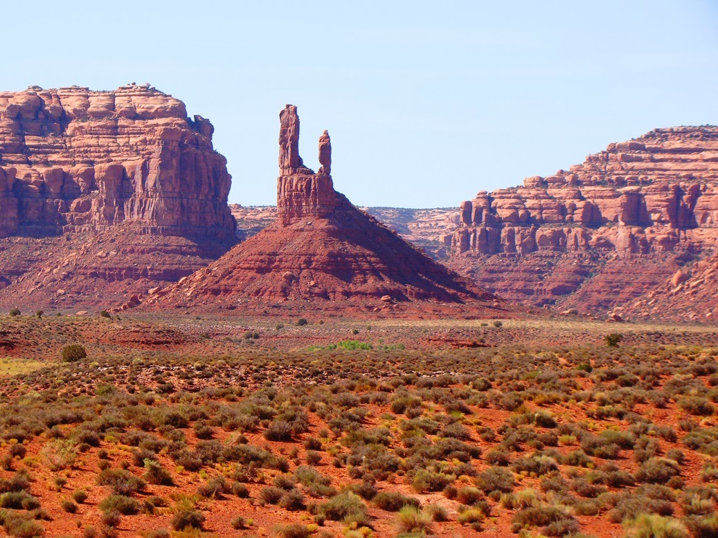
Our journey through America's Never Never was in its sixth day, and we were headed into one of the more isolated corners of the Colorado Plateau. After traveling through Monument Valley, we turned north into Mexican Hat, Utah, and headed up a gravel road into Valley of the Gods. This was new for me; in a quarter of a century, I somehow had never found the time to explore the 17 mile loop through a series of amphitheaters along the eastern margin of Cedar Mesa. It was a magical place.

The Sitting Hen at Valley of the Gods, from the back

I find myself speculating about the connections between magic and science when I am in a place like Valley of the Gods. Science has given us a "creation myth" about how these rock pedestals formed.  The cliff-forming unit is the Cedar Mesa Sandstone, which formed in coastal dunes and beaches in Permian time perhaps 270 million years ago. The underlying ledge-forming rock is the Halgaito Shale, which formed in coastal deltas and shallow marine conditions somewhat earlier in the Permian Period. The spires formed from cliff retreat as the softer Halgaito rock undercut the sandstone cliffs (I described the process in the previous post). Tricks and variations in the erosional process formed the hollows and shadows that give the pedestals their eyes and faces.
The Sitting Hen, or as I like to call it, the Rubber Ducky at Valley of the Gods.
So, who is to say that science has a better explanation for the origin of these features than others who see the shapes and ascribe their origin to gods or aliens or whatever? In ages past there was no technology to truly study the origin of these rocks, and no cultural experience with deltas, or river floodplains, or beaches. The people who observed these towers thousands of years ago were just as intelligent (if not more so) than people today, but they had no experience or written history that could record the appearance of rocks forming today in the environments listed above. So they described the rocks in a way that best explained what they saw within the limits of their technology. They saw people, animals, and monsters, and produced stories and adventures that explained how they could be turned to stone.
The Battleship, right out of Monopoly!

Does science deny the possibility of aliens carving these exquisite sculptures, or that gods turned miscreant humans into stone? Actually, science doesn't. It does in fact state that these other explanations could be true but that the probability is extremely low, based on the absolute paucity of supporting evidence. The scientific explanation is supported by extensive and overwhelming evidence. Scientists would acknowledge that the presently accepted explanation could be supplanted were new evidence were to emerge. Indeed they expect such changes in the fullness of time.

Compare this attitude to that of someone who has decided on an explanation, truly believes it, and chooses to ignore any contrary evidence. There is no growth, no increase in knowledge in such an person. Belief doesn't make it real, but evidence makes an explanation more likely.

Some might say that science removes the excitement and mystery of a good creation story. I would respectfully disagree. I would say that an understanding of geologic processes leads to more mystery and wonder. Consider the rocks; once one realizes that these rocks were part of a coastal complex, the question arises: where was the ocean and why was it in this place? Today the oceans are a thousand miles away. These rocks were eroded from a mountain range somewhere. Could we find where that mountain range was? Why did those mountains rise? What forces were acting on the crust to cause them to develop? What kinds of creatures lived on these floodplains and deltas? Where did they come from? What happened to them? As it turns out, the world was only a few million years from the worst extinction event ever to take place on planet Earth. Some 95% of all species on the planet vanished 252 million years ago. All these questions invite further study and further growth. Each effort to answer these questions adds to the body of human knowledge. It is a creation story that grows and changes with the addition of new data.

On the other hand, it's fun to play games with these fascinating forms of nature. What do you think they are?

I know this: they are beautiful to gaze upon, even if beauty is a subjective judgement. Did the humans who first saw these desert monuments see them as beautiful? Or were they simply part of a rugged harsh landscape that may or may not be hiding a resource that could extend human life in this tough land?
I definitely see a huge mechanical hand rising out of the ground.

We passed the base of Lady in a Bathtub (picture below) and drove back down to Mexican Hat for one last stop in civilization. We were headed onto Cedar Mesa, one of my favorite places, and perhaps the spiritual center of my personal Universe. More as this blog series continues.
The Lady in the Bathtub.

The loop road through Valley of the Gods is accessed from US 163 out of Mexican Hat, Utah, while the west entrance is on US 261 near the base of the Moki Dugway. There are no facilities along the loop, which is managed and maintained by the Bureau of Land Management. There is a small campsite at nearby Goosenecks of the San Juan State Park, but no water is available. But bring a camera or sketchpad!

On the Road Again: Into the Valley of Death (and check out a new geology blog)

$
0
0
It's finally dawning on me: I'm hitting the road again. With students! I often imagine while in a classroom of having the walls and doors fading away into an open landscape where the principles I am discussing appear in front of us and around us in perfect clarity. Such is the experience of teaching in the the most geological national park in the world: Death Valley National Park.
We will have four days working our way through two billion years of Earth history, with an opportunity of experiencing a sometimes deadly landscape during the part of the year when it is pleasantly warm instead of killer hot.
There are so many sights in this incredible national park. The Earth's crust has been stretched and broken, exposing much of the upper crust of the western United States.
I've no idea whether I'll be able to post while on the road. Stovepipe Wells has a notoriously undependable web connection, but if I get the chance, I'll drop in and send a few updates
In the meantime, have a delightful holiday weekend. We'll catch you later on! If you want to read some good geology writing while we are gone, may I recommend "Diary of a Geology Student"? My former student Becca has been putting up some excellent material in the last few weeks, especially this post about being a student these days.

So What Do You Gain From Teaching Anyway?

$
0
0
Black tourmaline (schorl) crystals in a muscovite pegmatite
It's been six years and 1,307 blog entries since I began Geotripper as sort of a lark. I had a lot of digital images of geological subjects, and lots of stories from twenty years of teaching, so I figured I had a few months of material to write about before I ran out of steam. I guess that didn't happen, and here I am, still excited to be telling the story of the Earth through my experiences as a community college professor. It's been a great life and career, and I couldn't be happier about my life choices.

When I started the blog, I had just finished my stint as the president of the Far Western Section of the National Association of Geoscience Teachers, and some of my first entries were abridged versions of my president's letters that appeared in the section's twice-yearly bulletin. These notes described some of the reasons it was important to teach geology, using the Burgess Shale of British Columbia, Kartchner Caverns in Arizona, and Mt. St. Helens as a springboard. The gist of my thesis was that geology was a fascinating science, but it was also critical to produce informed citizens who could vote intelligently on issues of science such as fossil-fuel dependence, global climate change, and land-use decisions.
A garnet crystal in quartz
Today brought me a different perspective. What does one get from teaching? It's taken me six years to get around to discussing the particular issue, and here is a clue: it's not the money. It's a good job and relatively secure, but it won't make you rich. It is a career that includes necessary dealings with complex bureaucracies that can be frustrating at times. And sometimes one must deal with students who don't seem to care about their education, and others just don't have the skills or tenacity to stick with it. Sometimes we lose them.

But sometimes it works and there are success stories. One is given the privilege of changing lives for the better. There is nothing quite like seeing people who seem hopeless find something deep within themselves and assisting them in their efforts to overcome economic disaster, mental illness, or cultural limitations to succeed and make their lives better. I've been buoyed up by watching people who were illiterate as adults fight their way through reading courses and eventually earn a degree.
These thoughts occurred to me because I had a bit of a surprise today. A big surprise, really. I was rushing to my office after teaching three hours of classes after getting home from our field studies trip late last night feeling tired and frazzled, when I hear my name. I turn, and there is a former student who has dropped in for a visit. He has a gift for me, he says, and hands me five or six very small pebbles. You were probably wondering why I was showing you pictures of rock samples in an article about teaching. On the face of it, they aren't overly remarkable: a nice little piece of tourmaline crystals in pegmatite, a garnet crystal in quartz, a couple of pieces of schist, and a rounded sphere of granitic rock. What's remarkable is where he picked them up...they were on the flanks of Mt. Everest. My student was part of an attempt to climb the world's highest mountain. Despite all the privations and exhaustion he must have felt, he thought to pick up a few stones for me, the person who taught him about rocks so many years ago.

To say I was touched is a huge understatement.
So, what do you gain from teaching?

Sometimes they come back to say thank you.

Out of the Valley of Death: Home from the road

$
0
0
Dantes View at Death Valley National Park
It's geology in the starkest terms. Death Valley is a place where the crust has been torn asunder, with valley floors lying below sea level next to peaks that reach 11,000 feet. Rocks here are rarely hidden by vegetation or soil. It's a land alien enough that George Lucas filmed parts of Star Wars here. It's a land that crushed the dreams of many people, and provided sanctuary for others.

The rocks of Death Valley record an unusually complete history extending from the early Proterozoic eon as much as two billion years ago to rocks that formed only a few centuries ago. It's hard to imagine a better place for teaching geology, and that's what I was doing over the last couple of days.
I bet no one has ever thought of taking a picture from this particular spot before!
The students were enthusiastic and curious, the weather was outstanding, and the scenery was on a grand scale. We'll explore some of the fascinating corners of this incredible landscape in the next few posts.
Some of the oldest rocks in the American west, metamorphosed around 1.7 billion years ago.

Out of the Valley of Death: A bit of life hangs on

$
0
0
Desert Gold near Ashford Mill
A visit to Death Valley generally comes with an expectation that conditions are going to be dry. The valley floor may average no more than 2 inches of rain in a normal year, and this year is far from normal. California is in the grip of an unprecedented drought, and few storms have broken through the unusually persistent high pressure belt this year. There have been exceptions, but my experience has been that February wildflower shows in Death Valley are rare, and this year I expected to see exactly zero flowers during our exploration of the valley.
Golden Poppy near Exclamation Point
So call this the most pleasant surprise of our trip. In the same way that a thirsty person appreciates even a drop or two of water, we were excited to see a scattering of just a few flowers in just one location within the largest national park outside of Alaska. The spot is below Jubilee Pass in the south part of the park, and just up the hill from Ashford Mill. The road here is paved, but the majority of visitors to Death Valley do not go this far south.
I don't know this diminutive flower
There have been years when the entire slope of the alluvial fan above Ashford Mill was covered with Desert Gold and other flower species, notably during El Nino years. It is a memorable sight to see the flowers growing in such profusion, but there is something about the flowers that manage to bloom when the conditions are so marginal that the continued existence of life is in question. These flowers stand alone in stark contrast to the barren soil and rock where other seeds hide beneath the surface. Those other seeds have somehow decided to wait for some future wet year instead of gambling on the pitiful amount of water in the ground this year.
Sand Verbena
 These hardy individuals are beautiful in their rarity.
Sand Verbena
As we walked across the alluvial fan surface looking for the outcrops of the Pahrump Group, it became clear why some of these flowers were able to bloom. They tended to congregate along the paved roads (runoff from the pavement gives a bit of a boost), and in low hollows where water could accumulate, and where the plants would be protected a bit from the drying hot winds.
Phaecelia
It's a bad water year. I don't foresee a big bloom unless the meteorological conditions change radically in the next few weeks, and that doesn't seem likely. So please enjoy the brief gift of a bit of color from these few hardy survivors!

Is Science Dead? In my town, a resounding "NO"!

$
0
0
Science is in trouble, they say. Kids just aren't interested in science careers, and schools hardly teach it anyway. And in the poorer parts of the country, the problems are even worse. No one cares anymore.

I beg to differ. I teach in one of the poorer parts of California, a town and county that has suffered depression-level unemployment levels even during the "good times" prior to the 2008 economic burp. Our schools suffered cut after cut, and the whole region pretty much went to hell with the highest foreclosure rates in the country, and some of the worst crime (at least it was of the property-stealing type instead of violence). And yet we are still here...

I couldn't be prouder of the people in my county and city. The state may have deserted us when times got tough, but we decided to take steps on our own to make life better for our children. One of them was a bond issue that resulted in the transformation of our community college campus.

Modesto Junior College is the second oldest community college in the state, established in 1922. And her age was showing. The Science Building in which I taught classes for 24 years was constructed in the 1950s with a partial renovation in the early 1990s to keep it from collapsing in a moderate earthquake (I felt so much better after that). The gas and power lines barely operated, and the teaching facilities and equipment were ancient as well. The climate-control was an ongoing joke. The technology environment was laughable. How bad was it? When we tossed out the old equipment, a fair amount was purchased by a Hollywood film organization that needed real-looking props for movies set in the fifties and sixties.

So it was when times were still relatively good (meaning unemployment dropped down to maybe 12% instead of 18%), the people in our region decided to invest in the future of education for our children. We don't have a California State University or University of California campus in our town, so MJC is the sole college choice, and we decided to transform it into one of the best community colleges in the state. Especially in the area of science education.

We've been teaching in the Science Community Center for not quite a year, and some parts of the building complex are still under construction. We have a new high-tech observatory, an advanced planetarium facility (the only newest-generation star projector in North America) and state of the art labs for teaching biology, astronomy, physics, chemistry, and the earth sciences. What's still to come? An incredible museum of natural history (the Great Valley Museum), and an Outdoor Education Laboratory that will include native plants and environments including a stream, a pond, and a "native" rock garden displaying samples from the surrounding mountains. I've felt a transformation in my teaching experience, and I'm beginning to sense a change in our community too. The events of the last two days were the catalyst for my thoughts and musings for today.
We used to have telescope viewing nights in our old digs. But we only had a lawn in a tree-filled quad full of security lights to set up the scopes. Mind you, I have nothing against trees; we fought hard to keep those grand old trees when a proposal arose tear them down for unrelated construction. But you couldn't see much in the sky.

Our Science center is three stories tall, but we made sure to include stair and elevator access to the roof along with a viewing platform and high walls to protect people from falling off. The walls also serve as a barrier to light pollution. We now have horizon-to-horizon viewing ability. And our community responded to the new opportunity; where we once had dozens show up for a viewing, we now have hundreds! Although our planetarium is not yet fully staffed, the shows we've offered thus far have been filled to capacity. I'm excited to be training to become one of the "planetarium pilots" for the presentations.

There was an additional twist. At the telescope viewing last night, we laid out some of our paleontology samples for the kids to see while they waited for a chance to look through the scopes. The skulls are new and valued additions to our collection. Few people know that the very first dinosaur ever discovered in California was found in our own county. The region has also been a rich locality for other ancient creatures including mosasaurs and ichthyosaurs of the Mesozoic, and in more recent time, sabertooth cats, mammoths, sloths and short-faced bears lived on the valley floor. The kids were fascinated to find out the heritage of the land they lived on.
I've been impressed how community-oriented the building is. There are common areas where students and teachers can mingle and work together. Exhibits are in place on all the floors, and there is a beautiful spiral staircase that encircles a four-story high DNA molecule. There is a beautiful plaza in the front of the building with benches inscribed with the names of the greatest pioneering scientists, and a beautiful fountain complex that illustrates mathematics acting in the physical world.


The astronomy-related events are just one aspect of the rejuvenation of science education in our region. Our monthly Modesto Area Partners in Science presentations are usually filled to capacity. The Science Olympiad that we sponsor for local high and junior high schools continues to grow and expand (more on that next week; it's happening next weekend). It is an exciting time to be a teacher in our region.

All of this happened because our community invested in their own future with the construction of the Science Community Center. Modesto now has an incredible facility for the teaching and promotion of science in our city, one of the best such complexes in the state. Our community has a lot of incredible potential, and the people here are just starting to unleash it. They can be proud of what they have done.


Out of the Valley of Death: Cutting our (shark) teeth as new geologists

$
0
0
Ropy lenticular cloud, southern Sierra Nevada on the Kern River. Photo by Mrs. Geotripper.
Our recent adventure in Death Valley National Park had some preliminaries. One doesn't just go headlong into the Valley of Death without a bit of preparation. I'm not really talking about survival gear as we face some harsh savage desert, but more preparation of the mind to be able to comprehend the incomprehensible idea of nearly two billion years of geological history. The rock exposures at Death Valley can make geologists from more humid climates cry with awe at the barren naked rock.
Photo by Mrs. Geotripper.
But what if you are a beginning geology student with maybe five weeks of an introductory course under your belt? Approaching Death Valley without some background and context is just begging for absolute information overload. So it was that we quietly introduced our students to the world of geology in a gentle landscape.

We left the previous evening, driving for four hours through the southern San Joaquin Valley. I talk a lot about how interesting the geology is in my home turf, and it is, but frankly, it's as interesting to drive through it at night as it is in the daytime! Maybe even more interesting...

We set up camp late at night at Ming Lake in Kern River County Park. We awoke to a strange ropy looking lenticular cloud off to the east (top of the post), and held our first class in the field, discussing the geography of our journey. We would be passing through a sort of structural nexus of California, with six provinces within view this day: the Great Valley, the Sierra Nevada, the Coast Ranges, the Transverse Ranges, the Mojave Desert and the Basin and Range. We talked about how geologists view a new landscape, establishing the types of rocks, and organizing the layers into formations, members and groups. We discussed the rock we could see from our campsite, and what we might find as we looked at it more closely. We reviewed the fossils that might be discovered. And we talked about Valley Fever.
We had been camping at the base of Sharktooth Hill, and we would have a chance to search for fossils in a formation called the Round Mountain Silt. The silt was deposited in a shallow sea that had existed here for many tens of millions of years in Mesozoic and Cenozoic time. Though the seas were shallow, the sediments were deep in this region, exceeding 50,000 feet. About 20 million years ago, large numbers of sharks and sea-going mammals had died in the region, and their teeth and bones were widely distributed. The number of teeth discovered thus far on Sharktooth Hill proper number in the millions, but the land is privately held (occasional digs are offered through the Buena Vista Museum of Natural History in Bakersfield). We would instead check out some more limited exposures on public land nearby. Some diligent searching usually ends in a few exciting discoveries.

The search was tempered somewhat by the knowledge that the fungal spores that cause Valley Fever have detected in these soils. The students were very cautious about raising any dust, and some wore face masks.

After an hour, a number of students had made some exciting discoveries. For most of them, it was the first time that they had discovered a fossil in place. There are around two dozen species of shark teeth known from these beds, as well as the fragments of bone from marine mammals like dolphins, whales, seals, and large extinct manatee relatives. Upwards of 140 species have been recovered from these layers, making it one of the most significant paleontology localities in the state of California.
My discoveries were modest, a few shark teeth and the tooth of a ray or skate. I spent most of my time helping the others develop the "eye". This usually involves finding a tooth in place, and letting them know it is in an area of a couple of square yards. With the confidence of knowing the tooth is actually there, they usually find it in short order.
With our introduction to geological interpretation complete, we headed across the oil fields of Bakersfield towards Highway 58, Tehachapi Pass, and the Mojave Desert. We were headed towards one of California's greatest state parks, Red Rock Canyon. Our trip had begun in earnest.

A bit of Geo-Graffiti

$
0
0
It's not the usual subject matter of the fence art in my local neighborhood. But I'll take the positive over the obscene any time...

And no, I didn't do it.

Out of the Valley of Death: Explorations in Red Rock Canyon

$
0
0
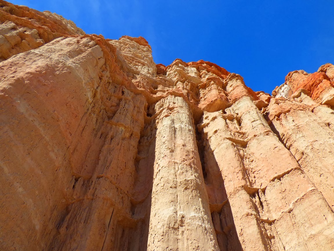
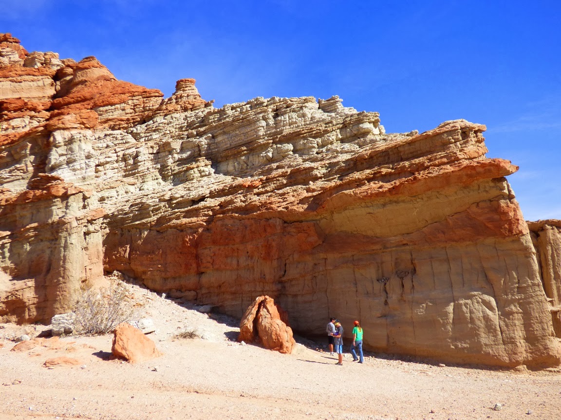
The next stop on our way to Death Valley National Park was one of the most ideal locations for learning the basics of stratigraphy to be found anywhere: Red Rock Canyon State Park in the El Paso Mountains along the Garlock Fault. The park protects exposures of the Miocene deposits of the Dove Springs formation (formerly the Ricardo formation), aged at about 8-12 million years. The formation of conglomerate, sandstone and claystone was laid down in alluvial fans, floodplains, and lakes in a semi-arid savanna environment. The region was home to a vast array of grazing mammals and predators, including extinct elephants, rhinos, three-toed horses, giraffe-like camels, saber-toothed cats, and bone-crushing dogs as well as smaller animals like ancestral skunks, martens, alligator lizards, rodents, and shrews. (follow the links to descriptions of each type of animal on the Los Angeles Natural History Museum website).
The park has stunning exposures of the sedimentary and volcanic rocks that illustrate many of the basic principles of stratigraphy (superposition, original horizontality, lateral continuity, and cross-cutting relationships). I worked with the students to observe and identify the rocks, and to work out a sequence of events that led to the formation of the exposures. And then I turned them loose to produce a rudimentary map of the geology of the area around the beautiful red cliffs.
It was February, and the sun was blazing! The temperature topped out at about 90 degrees. In a sense it was quite pleasant, especially compared to the frigid conditions back in the eastern United States, but it was also a reminder that we never had winter this year. There has been so little rain that there are parts of the Central Valley that have received less precipitation than Death Valley. It was a bit disturbing to realize how dry conditions are across the state.
Red Rock Canyon State Park has been the setting for numerous movies over the years, including old-time westerns, but my favorite movie scene was the opening sequence of Jurassic Park, where the protagonists were excavating velociraptors from Snakewater Creek or some such place in Montana. I sometimes find myself thinking "your cute little velociraptors wouldn't stand a chance against our bone-crushing dogs and sabertooth cats!".

Out of the Valley of Death: Dreams of the Water Times at Fossil Falls

$
0
0


The lands east of the Sierra Nevada are dry. The massive mountain wall of granitic rock captures the Pacific storms that reach California and wrings the moisture out, leaving barren deserts and culminating in the hottest spot in the world and the driest locality in North America: Death Valley. Rocks of course are superbly exposed in this landscape, but the overwhelming impression for most visitors is the dryness.

It wasn't always this way. Climate change happens on different scales. There is the very rapid climate change that we are enduring in the present day, where major changes are taking decades rather than centuries or millennia. And then there is the kind of change that happens on a time scale of tens of thousands of years. That has been happening in the eastern Sierra Nevada over the last two million years as the northern hemisphere alternated between cold wet periods and warmer stretches. These were the Pleistocene ice ages. Evidence for at least six glacial advances can be discerned in the rocks and sediments of the Sierra Nevada, but independent analysis of ocean core sediments suggests that at least a dozen glacial advances took place (larger events tended to erase the evidence of earlier but smaller events in land deposits).


And yet the rocks retain the memory of water. Or in non-anthropomorphic language, the rocks contain clear evidence of earlier periods of wetter climate. A popular stop for geology field trips in the eastern Sierra Nevada is Fossil Falls in the Coso volcanic field between Ridgecrest and Lone Pine. The attraction of the site isn't a fossil, but the evidence of a large flowing river in the desert.
The valleys east of the Sierra Nevada are there not there because of river erosion. They exist because the crust itself has been stretched to the breaking point, and faults have formed. Some blocks sank to form deep graben valleys, while other blocks remained elevated to form the high mountains (horsts). Previously existing river systems were disrupted and vast regions no longer drained to the sea. This area of interior drainage is called the Great Basin, and it extends from the Sierra Nevada to the Wasatch Front in the state of Utah.

During the wet and cold periods the glaciers didn't reach far down into the valleys east of the Sierra Crest. But they did melt, and the meltwaters collected in lakes in the bottom of the deep graben valleys. When the cold periods lasted long enough, the lakes would fill to overflowing and spill over into the next basin. Fossil Falls are situated between Owens Lake and China Lake, with the cinder cones, plug domes, and basaltic lava flows of the Coso volcanic field in between. Lava flows from cones like Red Hill (above) occasionally blocked the river that would sometimes flow between the two currently dry lakes (Owens Lake contained a thirty foot deep lake as recently as the 1920s, but water diversions to Los Angeles caused it to dry up; it would need to be several hundred feet deep before it could spill over again at Fossil Falls).

The strangely shaped rocks then originated as the Owens River flowed and spilled over the edge of the lava flow that stood in its path. The smallest irregularities in the basalt would cause swirls and eddies in the flow, and sand, gravel and pebbles would grind at the edges of the shallow basins, eroding and deepening them. Eventually they would become potholes, and some of the potholes at Fossil Falls are immense. At least one of them tunneled ten or twelve feet down and broke through the canyon wall (below), forming a climbing challenge for canyon explorers (I proved I could shimmy up the thing a decade or two ago, so I don't need to prove it anymore...).


There is life in the potholes. When rain fills some of them, eggs of fairy shrimp hatch and for a few short weeks the small arthropods live, grow, mate, and die, leaving their eggs to wait for the next wet year.

It is strange to stand at this ancient river bed and hear only the gusts of wind. One can travel in one's mind though, and start to hear the crashing waters, the verdant cottonwood trees rustling, and the sounds of animals coming to the river for a drink. There were mammoths at the time, and horses, and camels, along with the more familiar deer and pronghorn antelope. One might have spied a Sabertooth Cat, a Dire Wolf, or an American Lion lying in wait in the hope for a meal. In the latest times, humans hunted for game in this more equitable environment. Chips of obsidian and housing rings are still present.

2005 was an extraordinarily wet year, and storms were actively dumping water into the drainage upstream of Fossil Falls. That year was the one and only time I've ever seen water flow through the gorge. The little stream could never be mistaken for the torrent that once flowed through and carved the canyon, but it was beautiful to see an echo of the water times of the Owens River system.

Fossil Falls is on Bureau of Land Management lands, and has been "developed" as a recreation site, with a small parking lot, campsite, and restrooms. The trail to the fall is not long, about a quarter mile, but it has a few rough spots. Climbing around the potholes can be a little intimidating, but the views are great from the rim as well.

Action on our Seismometer Today: Earthquake Swarm or Volcanic Harmonic Tremor? (hint: no...)

$
0
0
 Frankly, if we lived next to a major fault zone or an active volcano, the seismic record above on our department seismometer would be worrisome beyond measure. Earthquake after earthquake usually means very bad things, the harmonic tremor leading to a major volcanic eruption or the buildup to a huge earthquake. Fortunately, I live in the Great Valley of California and such outcomes are unlikely. No, this seismometer is recording something much more positive: Science!

Or more to the point, it's the pounding footfalls of 500 or so enthusiastic future scientists running up and down the halls of our Science Community Center competing in the annual Regional Science Olympiad. The event brought teams from several dozen junior and senior schools to compete in 24 different events designed to test the creativity and rigor of the student's education in a variety of disciplines.
The competition is as intense as any football game, and the stakes are high. The winning schools will compete in the Northern California Science Olympiad, and the winners there will compete nationally. The enthusiasm of the students is palpable, even in the "secondary" events like Rocks and Minerals and Dynamic Planet that were conducted by the members of our campus geology club. I call them "secondary" because they don't always get the attention of glamour events like the bots, helicopters, and bottle rockets. What I and the coaches know, though, is that the competition is won and lost in these events, the trenches of scientific competition.
What that means is that unlike the football quarterbacks and receivers who get called heroes for bouncing an odd-shaped ball about, is that the geeks and nerds get the recognition and appreciation of their fellow students for bringing glory and victory to their schools. And since it takes a few dozen students to put a winning team together, they share richly in the accolades. That quiet kid in the back of the classroom who never says much but always has a few minerals in his or her backpack and a book on geology can be the winner of an event that puts their school over the top. He or she will never forget the moment.

And the best part? When they go on, they won't reach middle age with bad knees and constantly sore backs with faded memories of glory on the athletic fields. They will instead be the real heroes of society, being the doctors and scientists who bring about positive change in the world.
And that's not all. There are other heroes...there are the coaches and volunteers who put these teams together at the different schools and organize and train the students. There are the event judges, volunteers all, who design and conduct the various events. There are dozens and dozens of volunteers from the community who support the judges. Our county board of education has to be commended for their ongoing support of the program, which has now extended over decades without a break. All in all, there are hundreds of people coming together to support the concept of science education in our community.
There was one more star today as well. As my usual readers know, we only recently opened up our Science Community Center at Modesto Junior College for operations, a wonderful facility that has modern laboratories, a museum, an observatory, and one of the finest planetariums in the country. This incredible learning center happened because our community decided to support science education with the passage of a bond act that paid for it. This was no state program, or national initiative. It was the decision of the people in our community, one of the poorest in the nation, to make things better for their children.
So yes, there were earthquakes today. It was the pounding of hundreds of feet of students who may have a better future because their community insisted on it. Modesto and Stanislaus County can be proud of what they've accomplished.

The Other California: The Wetlands of the San Joaquin Valley, Actually Wet.

$
0
0

It's been a miserable year, one of the worst on record. For the last year much of California, including my home in the Great Valley, has received an amount of rain more appropriate to Death Valley than to one of the most fertile agricultural regions on the planet. It's been dry and dusty, and the farms in the valley have been surviving off of storage in the irrigation reservoirs, but after three dry years in a row, the reservoirs are on empty.
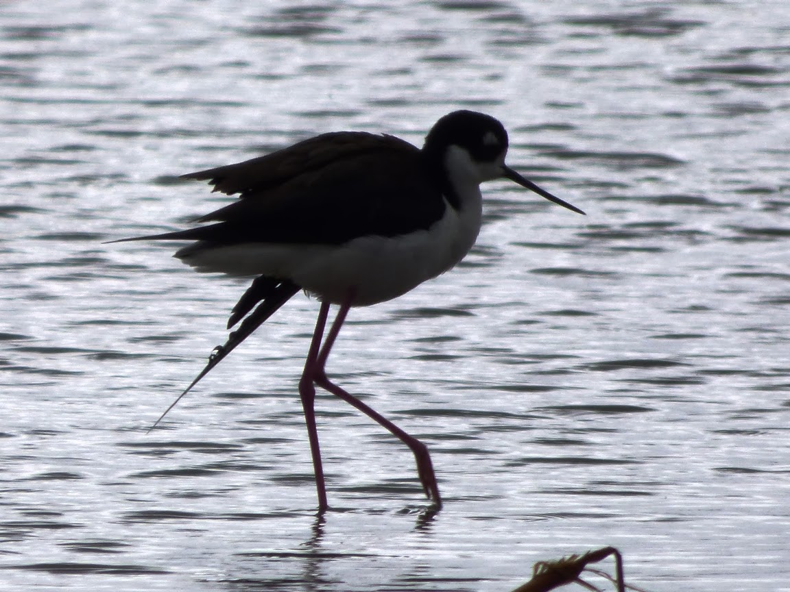
A Black-necked Stilt

In a valley where farming is king and 95% of the landscape is totally devoted to agricultural development, wildlife concerns take a back seat, especially when water runs short. The valley once hosted millions and millions of migratory birds, but during the development of the farmlands, lakes and marshes were drained and plowed, and what few birds persisted got themselves driven off or shot for consuming crops when natural forage was no longer available.
No, it's not drunk, and it's not falling over. A split second later it was airborne.

It would be nice to think that wildlife refuges were established to stabilize and preserve the original environment of the valley, but in some cases the motives were less noble: some, like the Merced National Wildlife Refuge where we visited yesterday, were designed to distract the birds from nearby farmlands where they were causing crop damage. And of course many refuges were designed to make it easier to "hunt" and shoot the birds. Whatever the original motive, their form and function has evolved. As we have come to understand the intricate nature of the migratory bird ecosystem, management of the refuges has begun to promote a stable winter home for numerous species. In some cases they have become spectacularly successful: the Merced Refuge protects 60,000 geese and 20,000 Sandhill Cranes. The refuges are managed as a complex ecosystem, with protection extended to the many other birds, mammals, reptiles, amphibians, fish and invertebrates.
A Black-necked Stilt and a Killdeer forage on the refuge road.

Our previous visits to the refuges (which we pretty much discovered only this year after living around here for a quarter of a century) have been dry times. Some of the fields were flooded but so little water was available. The drought has not broken, but we've finally received some rain, and on Sunday we paid a visit during a rainstorm. The birds seemed pleased, and the noise was almost deafening at times. It was delightful.

The Black-necked Stilts (Himantopus mexicanus) were especially common, and cooperated nicely with our efforts to get pictures, so they are the stars of today's post. "Stilt" is an appropriate enough name; their legs are ridiculously long, allowing them to wade in deeper water than some other birds.

There is only one Ibis in the American West, the White-faced Ibis (Plegadis chihi). We saw it for the first time on our last trip here, and were pleased to see it again. According to some of my guides, the bird is in decline California, primarily because of the need for large marsh areas for breeding. Those have been sorely lacking in these dry years.

They have one of the stranger looking beaks I've seen. They are obviously good for foraging deep in the mud.

Their feathers have a beautiful iridescence (that was not real obvious on this cloudy day).


The edge of the refuge include a few trees, still lacking their leaves. We were watching for raptors, but were thrilled to see a huge Great Horned Owl (Bubo virginianus) staring at us. Actually the stare was mildly disconcerting. The curve of their brows suggests malevolence, even though none presumably exists (I hope; given that birds are the only remaining dinosaurs in the world, I shiver to think of that stare coming from a creature fifteen feet tall).

I saw a fencepost off in the distance, but realized after a moment that it was actually a Great Blue Heron (Ardea herodias) standing very still. Another bird who cooperated nicely as we snapped a few pictures.

It is such an elegant looking bird!

We couldn't get very close to the vast flocks of Ross' Geese, Snow Geese and Sandhill Cranes, but we could see thousands of them off in the distance. The picture below is just part of the main grouping of Sandhill Cranes. The managers grow several hundred acres of corn on the refuge to feed the birds and give them full stomachs for the long flight north to their breeding grounds.

We stayed until the sun disappeared below the horizon in a beautiful sunset. This is the Great Valley at its best; I have been guilty of thinking of my home grounds as boring, bereft of geological interest and lacking much of anything resembling a natural environment that recalls the days following the last ice ages when wooly mammoths and dire wolves roamed the prairies, along with horses, camels, elk, bison, antelope, and saber-tooth cats. But here in the setting sun, with the cacophony of hundreds of thousands of birds, I felt a sense of how it once was before we "improved" the land.

The western sky was graced with a beautiful thin crescent moon.

The "Other California" is my long-neglected blog series on the places in my beautiful state that are often missed  by travelers from outside the region, especially those that tell a geological story. Toyota stole my idea, actually. I've never seen a tour bus full of foreign tourists stop at any of these refuges, but I imagine the sight of tens of thousands of geese soaring into the sky would be a sight that would impress any California visitor. And in the American West, the story of such a flat place, full of wetlands and marshes, is truly unusual, considering the geological violence that has occurred throughout the region, raising vast mountain ranges and high plateaus. The diversity of our landscapes, and the wide diversity of our native species is truly stunning.

Note: The San Joaquin Valley noted in the title is the name given the southern half of the Great Valley, from about Stockton to Bakersfield.

The Water Pirates: A Can a Day is All We Ask (plus 107 million gallons)

$
0
0
New orchard on the California prairie
It's a sad and familiar story for California: there is a valuable resource in the ground, free for the taking. There are those who come to exploit the resource, tearing up the land and leaving behind a wake of destruction. There are no laws to control the behavior of the miners, except for a few arcane rules from a previous century. In the end the resource is gone, and so is the chance for any sustainable use of the land for future generations. In the end, it was all about money, which landed in the hands of a few powerful people. It certainly didn't benefit the ones who did all the physical work.

This could describe the effects of the California Gold Rush of the 1850s, but unfortunately it is not. It is a story that is happening right now in my neck of the woods (prairie?), and the worst of the destruction still lies ahead. And right now, there isn't a whole lot anyone can do to stop it. It's not gold, it's water. And despite the fact that gold is worth somewhere around $1,000 an ounce, the water is far more valuable.

Our local paper, the Modesto Bee, has been running a series of reports recently including this one by reporter J.N. Sbranti that should receive much wider exposure. Almonds have become a valuable and profitable commodity these days, and there is a wild rush on to plant as many acres of almonds as possible. In many cases farmers are simply switching from corn or other yearly crops and putting in orchards. The most destructive aspect, however is the planting of some 30,000 acres of almonds and other nut trees on the former prairie and grazing lands east of Modesto adjacent to the foothills of the Sierra Nevada.

The problem with the trees on the valley floor is that one can't let the fields lie fallow in the driest of years like the one we are now suffering through. The trees must be watered or they die, and they require 4 acre-feet of water per acre each year. If the water gets prohibitively expensive, so what? They'll have to pay the price.
California's version of "snow". The almonds are beautiful when they are blooming.

What's worse are those almond orchards in the foothills. They can't be irrigated by normal means, as there is no infrastructure to deliver water there from the local irrigation district. The only source of water is from the ground, and there are few if any rules regarding the use of the groundwater. The large agribusinesses simply buy up the cheap grazing lands, put in the trees, and start pumping vast amounts of groundwater to water them. According to the Sbranti report in the Bee, the 30,000 acres of new orchards are consuming 39 billion gallons of groundwater each year, which is more than is currently pumped for domestic use across the entire county. The groundwater resource is limited, and will likely be depleted in the service of these orchards. When the water runs out, the orchards will die, but the owners will have gotten their cash. All legally of course, and damn the consequences.

It's all well and good to complain about government regulations, but theoretically government exists to watch over the well-being of the citizens. When there is no governance, the pirates take over, and we all lose. There oughta be a law, but I don't hear about anyone working on it. Much too arcane a political issue. At least until the wells run dry...

Viewing all 1203 articles
Browse latest View live